Sydney Harbour: How to See It Properly
How Sydney Harbour fits together, from Circular Quay to the Heads, with the ferries worth riding, the islands you can visit (and the one that's closed), free walks and viewpoints, and where it's safe to swim.
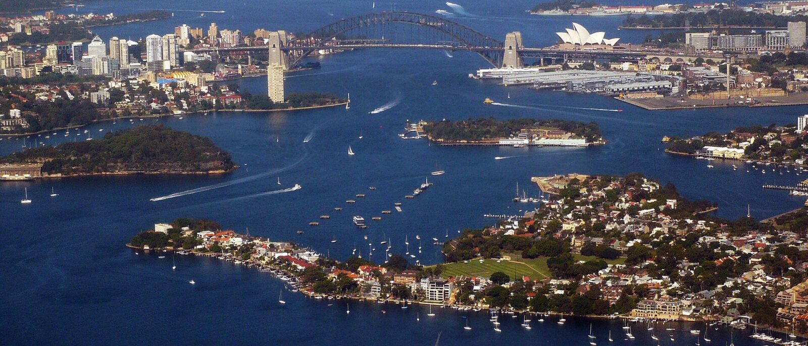
Most visitors see the same half-kilometre of Sydney Harbour: the stretch of water between the Opera House and the Bridge, seen from Circular Quay. It’s a wonderful half-kilometre, but it’s a bit like judging a city by its main square. Sydney Harbour is a drowned river valley that winds from the ocean at the Heads far inland up the Parramatta River, with dozens of bays, beaches, headlands and islands along the way and hundreds of kilometres of shoreline. The good news is that seeing it properly doesn’t take a cruise ticket or a lot of money. It takes a ferry map, a pair of walking shoes and a rough idea of how the pieces fit together.
This guide is that idea. It explains the harbour’s geography zone by zone, from Circular Quay to the Heads, covers the islands you can visit (and the famous one that’s closed), sets out which ferries to ride and why, and lists the best free walks, viewpoints and places to swim, with a few suggested harbour days to finish. It’s about the harbour itself rather than paid cruises; if you want to compare those, see our Sydney Harbour cruise guide. Details were checked in October 2026; treat prices as the right order of magnitude.
Sydney Harbour at a glance
| Detail | Sydney Harbour |
|---|---|
| Official name | Port Jackson, including Middle Harbour, North Harbour and the Parramatta and Lane Cove rivers |
| Traditional owners | The Gadigal and other clans of the Eora nation on the south shore; the Cammeraygal on the north shore |
| The hub | Circular Quay, on Sydney Cove, known to the Gadigal as Warrane |
| Getting around | Ten public ferry routes from Circular Quay, paid with a contactless card or Opal card |
| Budget “cruise” | The Manly ferry (F1): harbour sightseeing for a standard fare, A$9.20 for an adult on Opal or contactless |
| Protected land | Sydney Harbour National Park covers many headlands and several islands |
| Islands you can visit | Cockatoo Island (free, by ferry); Shark, Clark and Rodd islands (A$7 landing fee, pre-booked); Fort Denison is closed through 2026 |
| Swimming | Harbour beaches, netted enclosures and harbour pools; avoid swimming after heavy rain |
How the harbour fits together
The easiest way to understand Sydney Harbour is to imagine standing on the Harbour Bridge facing east, towards the ocean. The city and the eastern suburbs are on your right, the north shore is on your left, the Heads are straight ahead, and the inner harbour and the Parramatta River are behind you. Almost everything a visitor wants to see falls into one of six zones.
Circular Quay and Sydney Cove
Sydney Cove, where the First Fleet came ashore in 1788, is the heart of it all. Its waterfront, Circular Quay, is lined with ferry wharves, with the Opera House on Bennelong Point to the east, The Rocks and the Overseas Passenger Terminal to the west, and Customs House behind. Almost every ferry route starts here, and most harbour days do too. From here you can walk east around Farm Cove through the Royal Botanic Garden to Mrs Macquarie’s Chair, or west under the Bridge to Walsh Bay and Barangaroo. Our guide to Sydney’s landmarks covers the icons around the Quay.
The inner harbour: Barangaroo to Balmain
West of the Bridge, the harbour becomes more industrial, historic and residential. The old finger wharves of Walsh Bay are now theatres and restaurants, Barangaroo has swapped its container terminal for a headland park and towers, and Darling Harbour and Pyrmont lie beyond. Further west, the new Sydney Fish Market sits on Blackwattle Bay, and the old working suburb of Balmain occupies a peninsula of sandstone terraces and waterfront pubs. Out in the water are Goat Island and Cockatoo Island, and past them the harbour narrows into the Parramatta River. Our guides to Barangaroo and the Sydney Fish Market cover two of the highlights.
The north shore: Kirribilli to Taronga
Across the Bridge, the north shore is a string of leafy, expensive bays and headlands. Kirribilli, at the northern end of the Bridge, has the Sydney residences of the Prime Minister and the Governor-General on its point. Lavender Bay, Luna Park and Milsons Point sit just to the west. Heading east, you pass Neutral Bay, Cremorne Point, with one of the loveliest foreshore walks in Sydney, and Mosman Bay, before reaching Taronga Zoo on the slopes of Bradleys Head. Bradleys Head itself is a national park headland with a lighthouse, old fortifications and the mast of the first HMAS Sydney, set up as a memorial. Our Taronga Zoo guide covers the zoo.
The eastern shore: Woolloomooloo to Watsons Bay
East of the Botanic Garden, the southern shore of the harbour runs past Woolloomooloo, with its long timber Finger Wharf, and Garden Island, where you’ll see the grey warships of the navy’s fleet base. Beyond them are the grand old harbourside suburbs of Elizabeth Bay, Double Bay and Point Piper, then Rose Bay, where seaplanes take off from the water. Nielsen Park, in Vaucluse, has a sheltered harbour beach and a foreshore track back to Rose Bay. At the end of the peninsula is Watsons Bay, an old fishing village with a beach, fish and chips, and The Gap, where the land drops straight into the Pacific.
The Heads
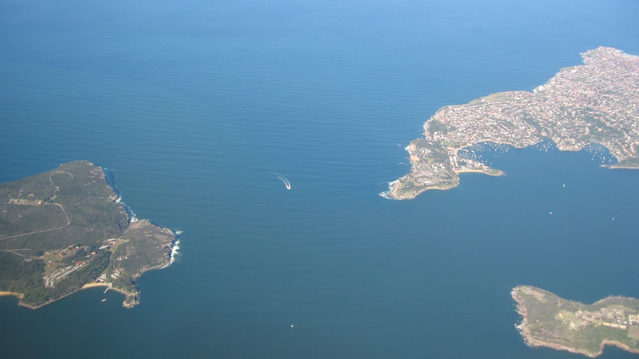
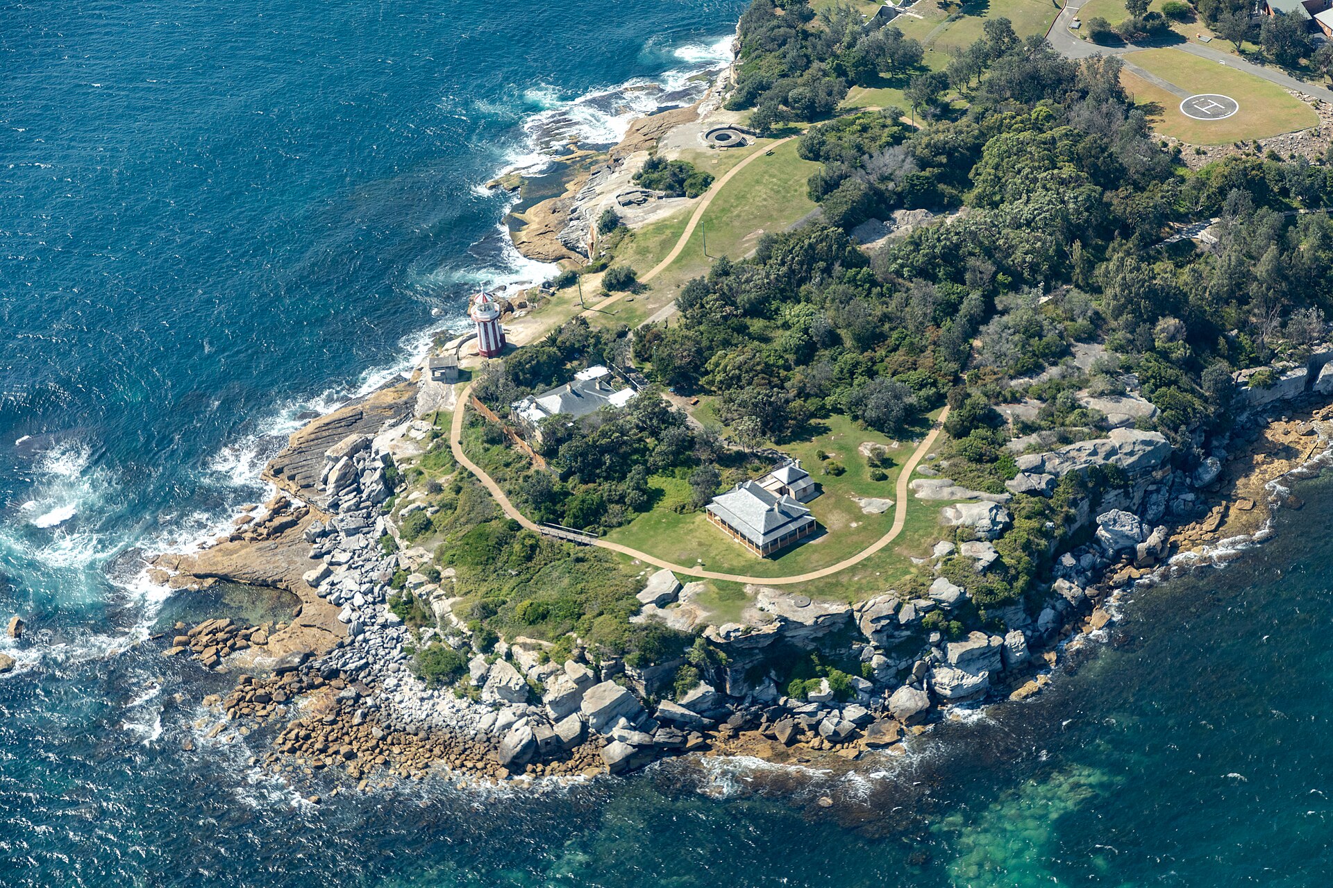
The Heads are the harbour’s entrance: North Head, a high sandstone plateau above Manly, and South Head, a narrow finger of land beyond Watsons Bay, with Middle Head in between on the north side. Between them, the swell of the Pacific rolls in, and the ferries to Manly start to pitch and roll. South Head has the red-and-white Hornby Lighthouse, built in 1858, and a short walking track with sweeping views; North Head has the old Quarantine Station and the Fairfax Lookouts, which look straight across the harbour mouth. Both are excellent spots to watch for whales from June to November. Our whale watching guide has the best lookouts.
Middle Harbour and North Harbour
Middle Harbour is a long, quiet arm that branches north from the main harbour, lined with bush, beaches and sailing clubs. Its best-known spots are Balmoral, a family favourite with a netted swimming area and a small rocky island joined to the beach by a footbridge, and The Spit, where a lifting bridge carries the road across the water and the Spit to Manly walk begins. North Harbour, the bay behind Manly, is a sheltered stretch of water with small beaches and bushland. Our guide to Manly covers the town at the end of the ferry ride.
The islands
Sydney Harbour has several islands, but only a few are open to visitors, and access has changed recently.
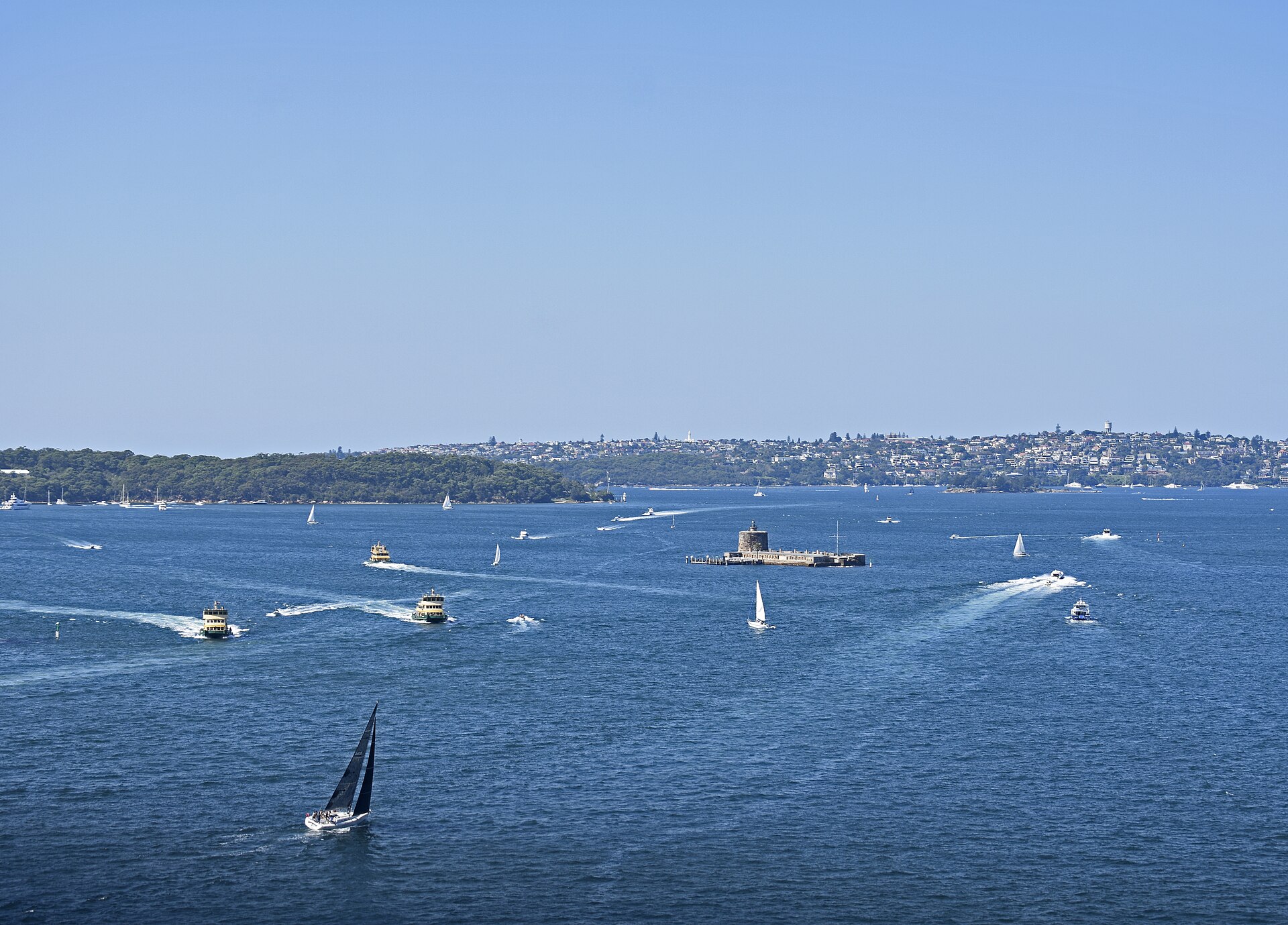
- Fort Denison, known to the Gadigal as Muddawahnyuh, is the famous fortified rock off Mrs Macquarie’s Chair, built in the 1840s and 1850s with a Martello tower. It’s closed through 2026 for conservation works and upgrades, with no tours or ferries running, so enjoy it from the water or the shore for now.
- Cockatoo Island, a World Heritage-listed convict prison and former shipyard up the harbour, is free to explore, reached by an ordinary ferry. It’s one of the most atmospheric half days in Sydney. Our Cockatoo Island guide has the details.
- Shark Island, or Boowambillee, off Rose Bay, and Clark Island, off Darling Point, are national park picnic islands. Captain Cook Cruises runs a ferry to Shark Island during school holidays, except when the island is booked exclusively; you can also arrive by private boat, water taxi or kayak. Either way you need a booking made in advance and a landing fee of A$7 per person. They’re open from sunrise to sunset.
- Rodd Island, in Iron Cove near Five Dock, is a small picnic island with the same A$7 booked landing fee.
- Goat Island, off Balmain, has convict-era buildings but very limited public access, and a few other islands are naval sites or closed to visitors.
How to get around the harbour
The ferries
Sydney’s public ferries are the best way to see the harbour, and they cost the same as a bus or train ride. Ten routes run from Circular Quay, each numbered from F1 to F10. You pay by tapping on and off with a contactless bank card, a phone or an Opal card, and daily and weekly caps keep a day of ferry-hopping cheap: the adult cap is A$9.65 a day on Fridays, Saturdays, Sundays and public holidays. Our ferry guide has timetables and tips, and our Opal card guide explains the fares.
| Route | Goes to | Why take it |
|---|---|---|
| F1 | Manly | The classic: the whole length of the harbour to the Heads in about 30 minutes |
| F2 | Taronga Zoo | A 12-minute hop to the zoo and the Bradleys Head walks |
| F3 | Parramatta River | The inner harbour and the river, with a stop for Cockatoo Island |
| F4 | Pyrmont Bay | Under the Bridge towards Barangaroo and Darling Harbour |
| F5 | Neutral Bay | A short north shore run past Kirribilli |
| F6 | Mosman Bay | The north shore bays, and the start of the Cremorne Point walk |
| F7 | Double Bay | The eastern suburbs’ harbourside villages |
| F8 | Cockatoo Island | The direct island service |
| F9 | Watsons Bay | East along the harbour to Watsons Bay, The Gap and South Head |
| F10 | Blackwattle Bay | A smaller service towards the new Fish Market |
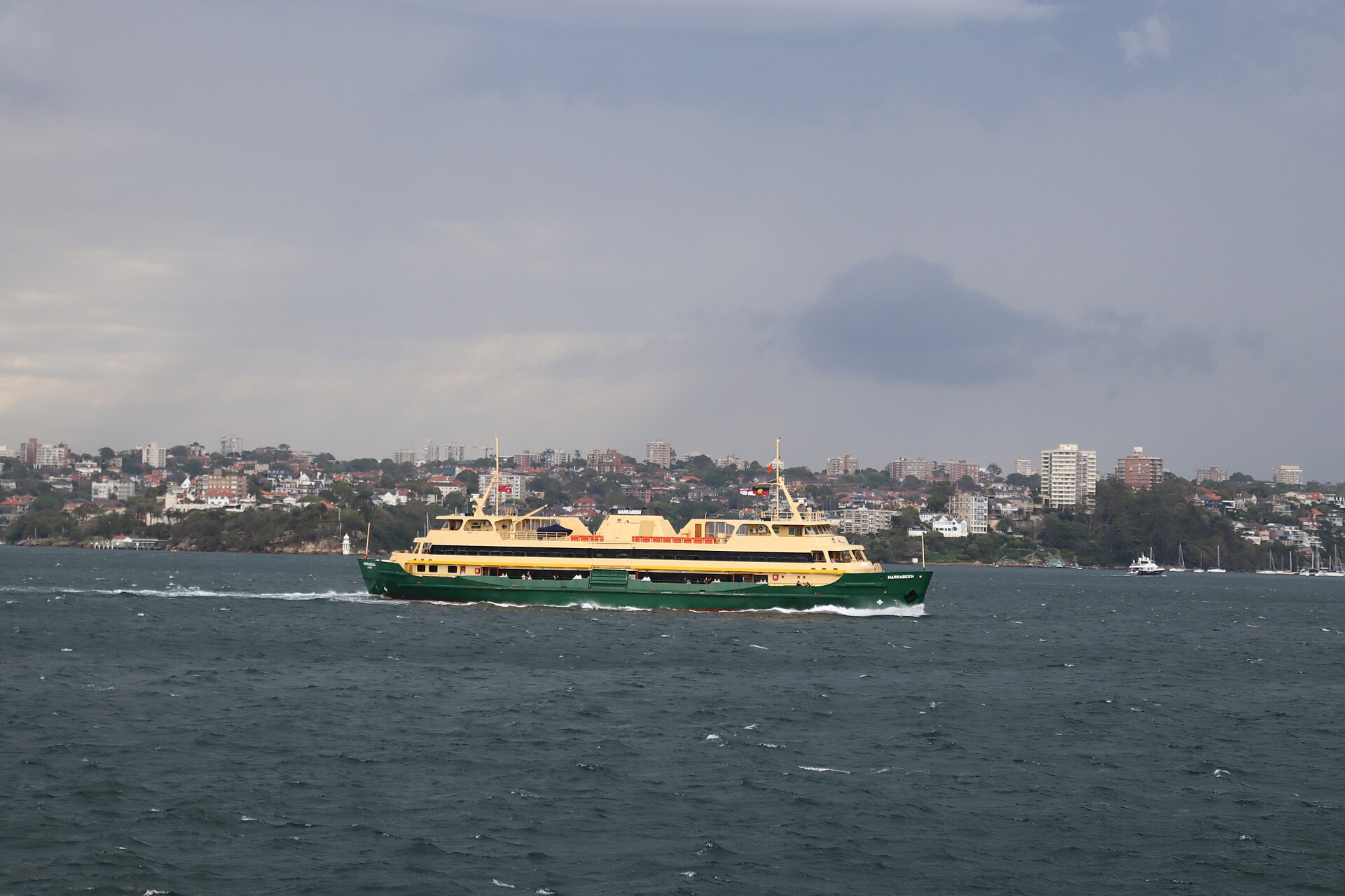
If you only ride one ferry, make it the F1 to Manly: sit outside at the front on the way out, past the Opera House, Fort Denison and the Heads, and at the back on the way home for the view of the Bridge and the city. The big Freshwater-class boats on this route have been carrying Sydneysiders across the harbour since the 1980s.
Water taxis, kayaks and boats
For places the ferries don’t reach, including Clark Island and, outside school holidays, Shark Island, water taxis can be booked to pick up and drop off at public wharves around the harbour. They’re expensive for one or two people but reasonable for a group. Kayak and stand-up paddleboard hire is available in several sheltered bays, including parts of Middle Harbour and Rose Bay, and paddling is a lovely way to explore the quieter corners, as long as you keep clear of the ferry lanes and check the wind. Several operators hire small boats you can drive yourself, which is how many locals get to the islands and beaches.
Paid cruises
Paid cruises add commentary, food and drink, and routes that the ferries don’t follow, from sunset and dinner cruises to whale-watching trips out through the Heads. Some are excellent, but for simply seeing the harbour, the public ferries do most of the job for a fraction of the price. If you do want a cruise, our cruise guide compares the types and the operators.
The best free ways to see the harbour
Harbour walks
- Circular Quay to Mrs Macquarie’s Chair: around the Opera House and through the Royal Botanic Garden to the classic view of the Opera House and the Bridge together. Our Royal Botanic Garden guide covers the route.
- Across the Harbour Bridge: free, open day and night, with the Opera House in front of you if you walk north to south. Our Harbour Bridge walk guide has the stairs, lifts and timings.
- Cremorne Point: take the ferry to Cremorne Point, walk around the point past Maccallum Pool, and continue along the foreshore to Mosman Bay for the ferry back. The city views across the water are superb.
- The Hermitage Foreshore Track: a short, pretty track through the bush from Rose Bay to Nielsen Park, with small beaches and views back to the city.
- Taronga to Balmoral: from the zoo wharf, follow the tracks out to Bradleys Head, then on past Chowder Bay and Middle Head towards Balmoral, a half day of bush, beaches and old forts.
- The Spit to Manly: the harbour’s great long walk, about 10 km of bush, beaches and headlands along Middle Harbour and North Harbour. It’s part of the longer Bondi to Manly walk.
Viewpoints
The best free harbour views are Mrs Macquarie’s Chair for the postcard, Observatory Hill above The Rocks for the Bridge, Blues Point Reserve at McMahons Point for the Bridge and the Opera House together, Cremorne Point and Bradleys Head for the city skyline across the water, and North Head and South Head for the ocean and the harbour entrance. At sunset, Barangaroo Reserve and the Opera House concourse are hard to beat; our sunset bars guide adds a drink to the view.
Swimming in the harbour
Yes, you can swim in Sydney Harbour, and on a hot day it’s one of the city’s great pleasures. The safest places are the harbour beaches and enclosures and the harbour pools.
- Harbour beaches: Camp Cove at Watsons Bay, Nielsen Park in Vaucluse and Balmoral in Middle Harbour are the favourites, with calm water and gentle sand. Murray Rose Pool at Double Bay is a netted harbour enclosure with a long pontoon.
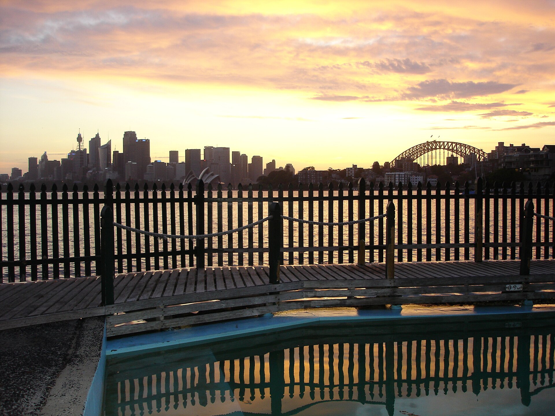
- Maccallum Pool: an old-fashioned public harbour pool on the western side of Cremorne Point, closed for a weekly cleaning that depends on the tide (North Sydney Council publishes the cleaning schedule), with a view of the Opera House and the Bridge across the water.
- Andrew (Boy) Charlton Pool: a heated outdoor saltwater pool on the edge of the Domain, overlooking Woolloomooloo Bay and the warships at Garden Island. Regular hours are 6am to 8pm daily and 7am to 7pm on public holidays, with possible changes over the summer holidays, so check the pool’s website for hours and entry prices.
- Dawn Fraser Baths: the historic tidal baths in Balmain are a seasonal pool, normally open from October to Easter, so check the council’s current opening information before you go.
Two safety rules matter. First, avoid swimming in the harbour for a day or more after heavy rain, when stormwater washes pollution into the water; the NSW government’s Beachwatch service publishes daily water-quality forecasts for harbour swimming spots. Second, bull sharks live in the harbour and prefer murky water, so stick to netted enclosures, swim in clear conditions and avoid dawn, dusk and river mouths. Attacks in the harbour are very rare, but there’s no reason to take chances. Our guides to ocean pools and family-friendly beaches have more options.
The harbour before 1788
For thousands of years before the First Fleet sailed in, the harbour was home to the clans of the Eora nation, who fished its bays from bark canoes, gathered shellfish on its rocks and camped on its beaches and headlands. Signs of that life are still there if you look: shell middens along the foreshores, and rock engravings of fish, whales and people cut into the sandstone at places such as Balls Head in Waverton and on headlands inside Sydney Harbour National Park. The national parks service now uses Aboriginal names alongside the colonial ones for several places, including Muddawahnyuh for Fort Denison and Boowambillee for Shark Island.
Two of the harbour’s best-known places carry the names of Eora people from the first years of the colony. Bennelong Point, under the Opera House, is named after Woollarawarre Bennelong, a Wangal man who lived there in a hut built for him by Governor Phillip. Barangaroo, on the western waterfront, is named after his wife, a Cammeraygal woman and a skilled fisher. The Royal Botanic Garden’s Aboriginal Heritage Tour is a good way to hear these stories on the harbour’s edge, and our guide to Aboriginal culture in Sydney lists more places and tours.
Where to stay for the harbour
If the harbour is the point of your trip, stay close to the ferries. The Rocks and Circular Quay put you next to the main wharves, the Opera House and the Bridge, with the most expensive views in the city; our guide to staying in The Rocks and Circular Quay covers the options. Manly offers the ferry ride as a daily treat, with the ocean beach on your doorstep, and the north shore suburbs of Kirribilli, Neutral Bay and Mosman are quieter, leafier and well served by ferries. Our where to stay guide compares the neighbourhoods.
The harbour through the year
- Summer (December to February): harbour swimming, packed beaches, the Sydney to Hobart yacht race setting off at 1pm on Boxing Day, New Year’s Eve fireworks and the ferry race on Australia Day. See our New Year’s Eve guide.
- Autumn (March to May): the calmest, clearest weather for walks and kayaking, with warm water into April.
- Winter (June to August): humpback whales passing the Heads, Vivid Sydney’s light shows around the harbour from late May to mid-June, and crisp, clear days. See our Vivid Sydney guide.
- Spring (September to November): whales heading south with their calves, warming water and jacarandas on the north shore.
Three ways to spend a harbour day
Ferry-hopping to the Heads
Take the F9 from Circular Quay to Watsons Bay in the morning, walk out to South Head and Hornby Lighthouse, then back past The Gap for fish and chips by the beach and a swim at Camp Cove. Ferry back to the Quay, change to the F1 to Manly, and walk up to North Head in the late afternoon for the view back across the harbour mouth. Return on the ferry at sunset, sitting at the back for the city lights.
The north shore on foot
Ferry to Cremorne Point and walk around the point, stopping for a swim at Maccallum Pool, and on to Mosman Bay. In the afternoon, take the ferry to Taronga Zoo, skip the zoo if you like, and walk out to Bradleys Head for the view of the city from the east. Return by ferry from the zoo wharf.
The inner harbour and the islands
Start with a morning on Cockatoo Island, exploring the tunnels and the old shipyard. Ferry back towards the city and walk from Barangaroo Reserve through Walsh Bay and The Rocks, then continue across to the new Sydney Fish Market for a late seafood lunch by the water. Finish with the ferry or light rail back to the city.
Sydney Harbour FAQ
Is Sydney Harbour the same as Port Jackson?
Yes. Port Jackson is the official name of the natural harbour, which includes Sydney Harbour proper, Middle Harbour, North Harbour and the Parramatta and Lane Cove rivers.
What’s the best way to see Sydney Harbour?
By public ferry. The F1 to Manly covers the length of the harbour to the Heads for a standard fare. Add a walk, such as Cremorne Point or the Harbour Bridge, for the views from land.
Can you swim in Sydney Harbour?
Yes, at harbour beaches such as Camp Cove, Nielsen Park and Balmoral, netted enclosures and harbour pools. Avoid swimming for a day or more after heavy rain.
Can you visit Fort Denison?
Not in 2026. It’s closed through the year for conservation works and upgrades, with no tours or ferries running. You can see it from ferries, the Harbour Bridge and the Royal Botanic Garden.
Which islands can you visit in Sydney Harbour?
Cockatoo Island is free and served by public ferries. Shark, Clark and Rodd islands are national park picnic islands with a pre-booked landing fee of A$7 per person. Captain Cook Cruises runs a ferry to Shark Island during school holidays, except when the island is booked exclusively; otherwise you arrive by private boat, water taxi or kayak.
How long is the ferry from Circular Quay to Manly?
About 30 minutes on the F1, which costs a standard ferry fare with a contactless card or Opal card.
Are there sharks in Sydney Harbour?
Yes, including bull sharks, but attacks are very rare. Swim at netted enclosures and patrolled spots, in clear water, and avoid swimming after heavy rain.
Is a Sydney Harbour cruise worth it?
For simply seeing the harbour, the public ferries are better value. A paid cruise is worth it for a special occasion, a dinner or sunset trip, or whale watching out through the Heads.
Sydney Harbour’s islands each work differently. Fort Denison is closed throughout 2026, Shark, Clark and Rodd islands need a booked landing (Shark Island also has a Captain Cook Cruises ferry during school holidays, except when it is booked exclusively), and Cockatoo Island is a ferry ride away. Our harbour islands guide goes through them one by one.
Related Sydney guides
- Sydney landmarks: the icons around the harbour, explained.
- Walking the Harbour Bridge: the free footpath and the BridgeMuseum.
- Sydney ferry guide: routes, fares and tips.
- Sydney Harbour cruises: when a paid cruise is worth it.
- Cockatoo Island: the island you can explore for free.
- Whale watching in Sydney: the Heads in whale season.
- Sydney’s best ocean pools: more places to swim.
Photo Credits
Sydney Harbour from the air: Aerial view of Sydney Harbour by Andy, CC BY-SA 2.0, via Wikimedia Commons.
North Head and South Head: AerialViewNorth&SouthHeads by Stasven, CC BY-SA 3.0, via Wikimedia Commons.
Hornby Lighthouse, South Head: Sydney (AU), Hornby — 2019 — 2599 by Dietmar Rabich, CC BY-SA 4.0, via Wikimedia Commons.
Fort Denison from the Harbour Bridge: Sydney Fort Denison and Sydney Harbor seen from the bridge below Pylon Lookout by Ymblanter, CC BY-SA 4.0, via Wikimedia Commons.
Manly ferry: Freshwater class ferry MV Narrabeen by State Transport Regions, CC BY-SA 4.0, via Wikimedia Commons.
Maccallum Pool, Cremorne Point: McCallum Pool Sydney by Wiebke Grauel, CC BY 2.5, via Wikimedia Commons.