Ku-ring-gai Chase National Park: Walks, Lookouts and Rock Art
West Head Lookout, Bobbin Head, the Aboriginal Heritage Track and the train-station walks: how to see Ku-ring-gai Chase National Park, with entry fees and access.

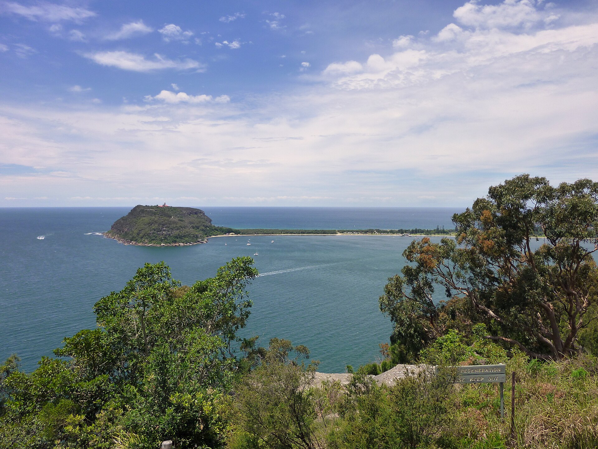
From West Head Lookout, at the northern tip of the park, you look straight across the mouth of Pittwater to Barrenjoey Lighthouse and the long sweep of Palm Beach, with Lion Island crouched in Broken Bay and the Central Coast beyond. It’s one of the great views in Sydney, and it’s barely 45 minutes’ drive from the northern suburbs. Ku-ring-gai Chase National Park wraps around it all: 15,000-odd hectares of sandstone ridges, deep, drowned river valleys and quiet bays, with some of the most accessible Aboriginal rock art anywhere near a major city.
This guide covers the park’s main areas (West Head, Bobbin Head and the train-accessible western side), the lookouts, the walks worth doing, where to see rock engravings and art, getting there with and without a car, and the entry fee. Details were checked in September 2026. Tracks close for works and after storms, so check National Parks alerts on the day you go.
Ku-ring-gai Chase at a glance
| Detail | What to know |
|---|---|
| Where | Northern Sydney, between Pittwater, Broken Bay and the Hawkesbury River |
| Established | 1894, one of Australia’s oldest national parks |
| Entry fee | A$12 per vehicle per day, or pay via the Park’nPay app |
| Main areas | West Head, Bobbin Head, Cottage Point and the western tracks from train stations |
| Best lookout | West Head Lookout |
| Rock art | Engravings and hand stencils, including on the Aboriginal Heritage Track |
| Visitor centres | Bobbin Head, 10:00–16:00 daily; Kalkari Discovery Centre, 09:30–16:30 daily |
| Train stations | Mount Colah, Mount Kuring-gai, Berowra and Cowan |
| Ferry access | The Basin, by ferry from Palm Beach |
A little history
Long before it was a national park, this country of ridges and waterways was home to Aboriginal people for many thousands of years. The engravings, middens and shelters across the park are the record of that long occupation. European colonisation from 1788 brought smallpox, dispossession and violence that devastated local clans within a few decades.
The park was proclaimed in 1894, making it one of the oldest in Australia, after Royal National Park south of the city. The word “Chase” in the name comes from the English term for an unfenced hunting reserve, which tells you something about late-Victorian ideas of what parks were for. Today it’s valued as a conservation area, a place for recreation close to a city of five million people, and a landscape of great cultural significance. Our guide to Sydney’s culture and heritage puts it in the wider story.
How the park is laid out
Ku-ring-gai Chase is big and cut into pieces by water, which matters because the different sections don’t connect by road. You can’t drive from Bobbin Head to West Head without leaving the park and going around. Pick your area before you set off.
- West Head: the north-eastern peninsula between Pittwater and Cowan Creek, reached from Terrey Hills along West Head Road. It has the famous lookout, beaches, the Aboriginal Heritage Track and most of the park’s rock art sites.
- Bobbin Head: a picnic area, marina and visitor centre on Cowan Creek in the park’s centre, reached from Turramurra or Mount Colah. It’s the family-friendly hub.
- The western side: walking tracks from railway stations on the main northern line, descending to Cowan Creek and Bobbin Head.
- Cottage Point: a tiny waterside hamlet on Coal and Candle Creek, known for its restaurant and kayak hire.
- The Basin: a calm beach and campground on the Pittwater side, reached by ferry or on foot.
Getting there
By car
The park is most easily explored by car. For West Head, drive to Terrey Hills and follow the long, winding West Head Road to the lookout at the end, passing most trailheads on the way. For Bobbin Head, take Bobbin Head Road from North Turramurra or Ku-ring-gai Chase Road from Mount Colah. Both wind steeply down to Cowan Creek. Pay the A$12 per vehicle daily entry fee at the entry stations or through the Park’nPay app. Vehicles with more than eight seats pay per person instead.
Parking at West Head Lookout and Bobbin Head fills early on sunny weekends. Arrive before 10am.
By train
The park is unusual in being properly reachable by train. Mount Colah, Mount Kuring-gai, Berowra and Cowan stations on the northern line all sit on the park’s western edge, and walking tracks lead from them down into the valleys.
- From Mount Kuring-gai or Berowra stations, tracks descend to Cowan Creek and on towards Bobbin Head. You can walk from one station to the other through the park.
- From Mount Colah, the road route to Bobbin Head passes the Kalkari Discovery Centre.
These are proper bushwalks with big descents and climbs back up, not strolls, so allow a full day. Check the Sydney train network guide and our Opal card guide for fares.
By ferry
Ferries from Palm Beach Wharf cross Pittwater to The Basin, on the park’s eastern shore. It’s the easiest way to reach the park without a car, and it combines well with a day at Palm Beach. See our Palm Beach day trip guide for the ferry and the Palm Beach side.
West Head
West Head Lookout
At the end of West Head Road, a short path leads to the lookout platform. The view takes in Barrenjoey Headland and Palm Beach to the east, Lion Island in the middle of Broken Bay, and the Central Coast’s Bouddi and Box Head to the north. In whale season, roughly May to November, you can sometimes spot humpbacks passing the heads. Come early on a clear morning, or late afternoon when the light warms the sandstone. For whale-spotting from the city, see our whale watching guide.
Honest note: the lookout itself is small and gets crowded on weekends, and the car park is tight. It’s worth the drive, but if you arrive to find it jammed, do one of the walks first and come back.
West Head walks
| Walk | Length | Why do it |
|---|---|---|
| Aboriginal Heritage Track | About 4.4–5 km, 3 hours | Rock engravings, hand stencils and views down to Resolute Beach |
| America Bay Track | About 2 km return | Short, easy walk to a waterfall (after rain) and views over America Bay |
| Red Hands Cave | Part of the Resolute loop | Ochre hand stencils in a sandstone overhang |
| Resolute Beach and West Head Beach | Various routes from the West Head Road trailheads | Secluded beaches facing Pittwater and Broken Bay |
Track lengths vary by source and route, and some tracks link up into longer loops. Pick up the park map, or download it before you go, because mobile reception is patchy on West Head. In September 2026, the West Head Army Track was closed on weekdays for works. Always check the alerts first.
Aboriginal rock art
Ku-ring-gai Chase holds one of the richest concentrations of Aboriginal sites in the Sydney region, including rock engravings (petroglyphs) cut into flat sandstone platforms, ochre hand stencils in overhangs, shell middens along the waterways and axe-grinding grooves. The engravings show figures, animals such as fish and kangaroos, and ancestral beings. They’re part of a living culture, not relics, and some sites carry deep spiritual significance.
The easiest way to see them:
- The Aboriginal Heritage Track at West Head passes several engraving sites and a painted overhang on a walk of around three hours.
- Red Hands Cave, on the Resolute loop, shows ochre hand stencils in a sandstone overhang.
- The Basin Track, off West Head Road, passes a large engraving site on the way down to The Basin.
How to visit respectfully: stay on paths and viewing areas, never walk on engravings, don’t touch or trace art, and don’t chalk or wet engravings for photos. The engravings are faint and best seen in low, raking light, early morning or late afternoon, or after light rain. Guided cultural tours led by Aboriginal guides run in the park at times and add a great deal of meaning. For the wider story, see our guide to Aboriginal culture in Sydney.
Bobbin Head
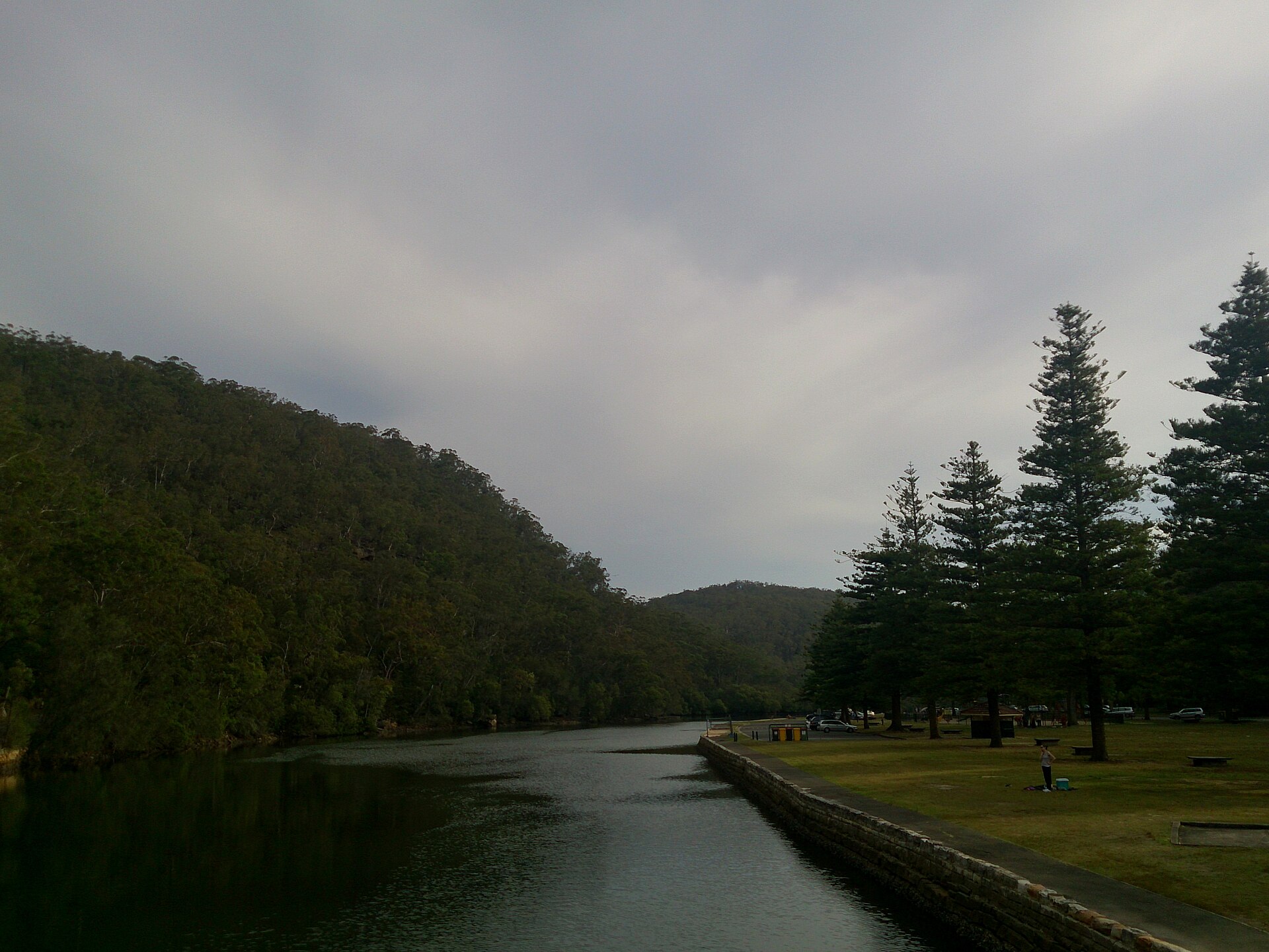
Bobbin Head is the park’s gentle side: a broad grassy picnic area under tall Norfolk Island pines on the banks of Cowan Creek, with a marina, the Bobbin Head Visitor Centre (open 10:00–16:00 daily), a small store and a lunchtime restaurant. Families spread out with picnics and barbecues, boats come and go, and goannas patrol the picnic tables looking for scraps. Don’t feed them.
Things to do at Bobbin Head
- The Gibberagong Track, a mangrove boardwalk walk from the picnic area.
- Hire a boat or kayak from the marina and explore Cowan Creek’s quiet side arms.
- Junior ranger activities run by National Parks in school holidays.
- Picnic and barbecue by the water, and arrive early on weekends to get a good spot.
Kalkari Discovery Centre
On Ku-ring-gai Chase Road on the way down to Bobbin Head from Mount Colah, the Kalkari Discovery Centre is open 09:30–16:30 daily (closed Christmas Day). It has wildlife and cultural displays and the short Kalkari Discovery Trail through the bush, where you may see lyrebirds and wallabies. It’s a good stop with children. Park entry fees apply.
On the water
Much of Ku-ring-gai Chase is best seen from a boat. Cowan Creek, Coal and Candle Creek and the bays off Pittwater are long, sheltered, steep-sided waterways where it’s easy to find a quiet cove. Kayaks and small boats can be hired at Bobbin Head and Cottage Point, and larger hire boats operate from marinas on Pittwater. Stay aware of wind and tides, carry water, and give way to larger vessels.

The Basin
On the Pittwater shore, The Basin is a sheltered, shallow beach with a big grassy campground, picnic areas and resident wildlife, including wallabies and goannas. It’s reached by ferry from Palm Beach, or on foot down The Basin Track from West Head Road, which passes the engraving site. Camping must be booked through National Parks, and summer weekends and school holidays book out well ahead. For day visitors, it’s a gentle, quiet contrast to the crowds across the water at Palm Beach.
Cottage Point
Tucked away at the end of a winding road off McCarrs Creek Road, Cottage Point is a tiny cluster of waterside houses at the junction of Cowan Creek and Coal and Candle Creek. There’s a kiosk with kayak hire and a well-known restaurant that people travel to by car, boat and even seaplane. Paddling out from Cottage Point into the quiet side creeks is one of the most peaceful ways to see the park, and far less busy than Bobbin Head. Parking is very limited, so arrive early on weekends.
Wildlife to look out for
- Goannas (lace monitors) around picnic areas, especially at Bobbin Head and The Basin. They’re impressive, and they bite if you try to feed them.
- Swamp wallabies in the bush, particularly early and late in the day.
- Superb lyrebirds in the gullies. You’ll often hear their astonishing mimicry before you see them.
- White-bellied sea eagles circling over Pittwater and Cowan Creek.
- Echidnas trundling across tracks on warm days.
- Wildflowers in late winter and spring, including waratahs, boronia and flannel flowers on the sandstone heath.
Camping
The main campground in the park is at The Basin, reached only by ferry or on foot, which keeps it pleasantly car-free. It has grassy sites and basic facilities, and is very popular with families. Check the current facilities list when you book. Book through National Parks well in advance for summer weekends, Easter and school holidays. Bring everything with you, including food, because there’s no shop.
Suggested days in the park
West Head highlights (by car)
- Morning: drive in early and do the Aboriginal Heritage Track while the light is low.
- Late morning: West Head Lookout.
- Lunch: picnic at a West Head picnic area. There are no shops on West Head, so bring everything.
- Afternoon: the short America Bay Track, or a walk down to a beach.
Family day at Bobbin Head
- Morning: Kalkari Discovery Centre and its short trail.
- Late morning: drive down to Bobbin Head and walk the Gibberagong mangrove boardwalk.
- Lunch: barbecue by Cowan Creek.
- Afternoon: hire a kayak or paddleboat for an hour.
Car-free day
- Take the ferry from Palm Beach to The Basin, swim, picnic and walk up towards the engraving site, then return by ferry. Combine it with an afternoon at Palm Beach.
- Or take the train to Mount Kuring-gai and walk down to Cowan Creek and on to Berowra station, for experienced walkers with a full day.
When to go
| Season | What it’s like |
|---|---|
| Summer (Dec–Feb) | Hot, humid, busy picnic areas; walk early; bushfire danger days can close the park |
| Autumn (Mar–May) | Settled, mild weather and the best walking conditions |
| Winter (Jun–Aug) | Cool, clear days, whales off West Head, quiet |
| Spring (Sep–Nov) | Wildflowers across the sandstone heath, including waratahs in some years |
Safety and practical tips
- Check alerts on the National Parks website before you go. Tracks and roads close for works, storms and fire danger.
- Carry water. There’s none on most tracks, and the sandstone heat reflects in summer.
- Bring food to West Head, where there are no shops.
- Tell someone your plans for longer walks, and download maps offline.
- Watch the time on train-station walks. The climb back out of the valley takes longer than the walk down.
- Respect cultural sites. Never walk on engravings.
- Don’t feed wildlife, especially goannas and birds at picnic areas.
Is Ku-ring-gai Chase worth visiting?
Yes, especially if you want bush, water and Aboriginal heritage without driving for hours. It’s closer and less crowded than the Blue Mountains, with a completely different character: waterways instead of cliffs, and rock engravings you can see within a few minutes’ walk of a road. The honest drawbacks are that you really need a car to see its best parts in a day, facilities are limited outside Bobbin Head, and the famous lookout is busy at weekends. For walks elsewhere near Sydney, compare our Blue Mountains walks guide and the coastal Bondi to Manly walk.
Frequently asked questions
How much does it cost to enter Ku-ring-gai Chase National Park?
A$12 per vehicle per day. Vehicles with more than eight seats pay A$4.40 per adult and A$2.20 per child. You can pay at entry stations or through the Park’nPay app. Walkers and ferry visitors arriving without a vehicle don’t pay the vehicle fee.
How do I get to West Head Lookout?
Drive to Terrey Hills and follow West Head Road to its end. There’s no public transport to West Head Lookout.
Can you see Aboriginal rock art in Ku-ring-gai Chase?
Yes. The Aboriginal Heritage Track at West Head, Red Hands Cave and The Basin Track all pass engravings or hand stencils. Visit respectfully and never walk on engravings.
Can you get to Ku-ring-gai Chase by train?
Yes. Mount Colah, Mount Kuring-gai, Berowra and Cowan stations are on the park’s edge, with walking tracks into the park. They’re full-day bushwalks rather than short strolls.
What is there to do at Bobbin Head?
Picnics and barbecues by Cowan Creek, the Gibberagong mangrove boardwalk, boat and kayak hire, the visitor centre (10:00–16:00 daily), and the nearby Kalkari Discovery Centre (09:30–16:30 daily).
Is Ku-ring-gai Chase good for kids?
Yes. Bobbin Head’s picnic area, the Kalkari Discovery Centre, short walks such as America Bay, and the calm water at The Basin all suit families.
Can you swim in Ku-ring-gai Chase National Park?
At some beaches, including The Basin and beaches around West Head. Most of the park’s waterways are estuaries without lifeguards, so swim with care.
Related Sydney guides
- Day trips from Sydney — every option near and far.
- Palm Beach day trip — the view from West Head, up close.
- Northern Beaches guide — the peninsula across Pittwater.
- Aboriginal culture in Sydney — the wider story behind the rock art.
- Sydney culture, history and heritage — for the city.
- Family day trips from Sydney — more ideas for kids.
Photo Credits
View from West Head Lookout: View from West Head Lookout by Travelstine, CC BY-SA 4.0, via Wikimedia Commons.
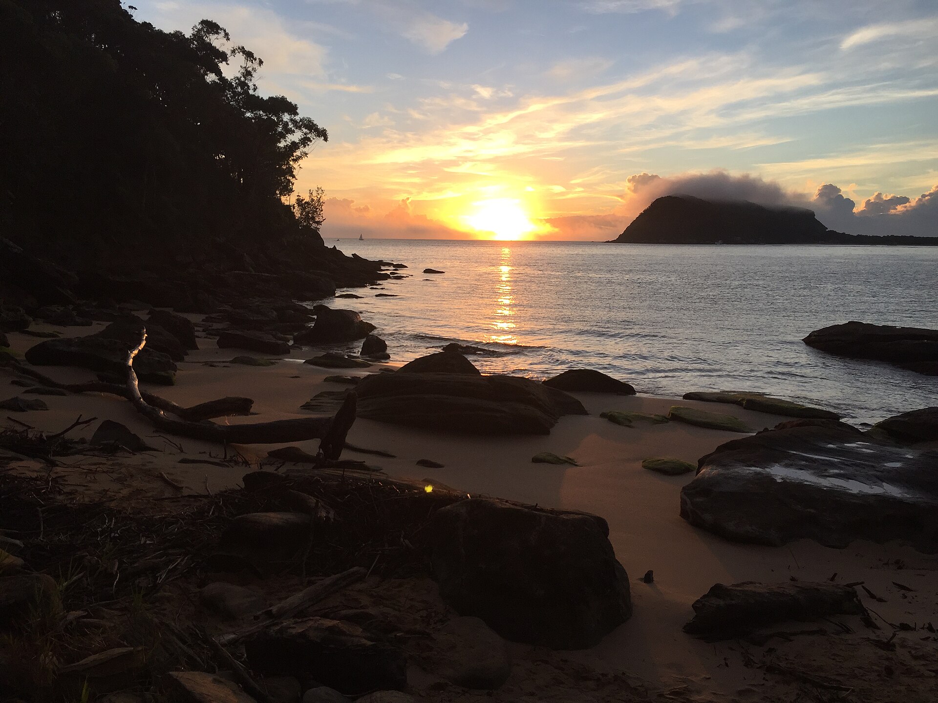
Beach below West Head at first light: West Head Beach Sunrise by Jackson A Douglas, CC BY-SA 4.0, via Wikimedia Commons.
Bobbin Head picnic area: Bobbin Head (11186548445) by FotoSleuth, CC BY 2.0, via Wikimedia Commons.
Kayaking to a secluded beach: photograph from the site library, via Pexels.