Wentworth Falls: Tracks, Lookouts and How Long It Takes
Wentworth Falls in September 2026: the lookouts, the walks that are open, the National Pass sections closed by landslide, and how long each route actually takes.
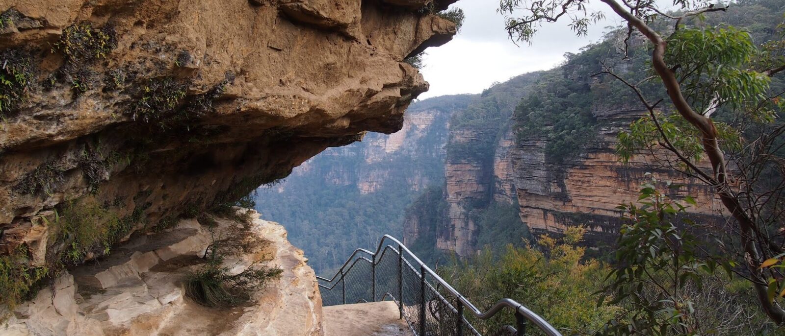
There are two things called Wentworth Falls and confusing them will cost you an afternoon. One is a small mid-mountains village with a railway station, a shopping strip and a lake. The other is a waterfall about two kilometres south of it, dropping roughly 190 metres off the escarpment in two big stages, with a network of hand-cut cliff tracks around it that is among the finest walking country in Australia — and, right now, substantially closed.
This guide covers the falls, the lookouts, the tracks that are open, the tracks that are not, and how long each one actually takes. The closure information was checked against NSW National Parks on 9 September 2026 and matters more here than anywhere else in the Blue Mountains. Check it again on the morning you go.
At a glance
| Detail | What to know |
|---|---|
| Where | Wentworth Falls, mid Blue Mountains, two stops before Katoomba |
| Getting there | Blue Mountains Line from Central, about 1 hr 50 min, ~A$9 each way |
| Station to the falls lookouts | About 2 km, 25 minutes on foot, downhill out |
| Height of the falls | Around 190 m over two main stages |
| Cost | Free. Some drive-in areas charge vehicle entry |
| Easiest walk | Charles Darwin Walk, about 90 min from the village |
| Best short lookout walk | Princes Rock, about 40 min return |
| Closed right now | National Pass west of the middle crossing; Wentworth Pass; Slack Stairs; Valley of the Waters below Sylvia Falls |
| Track conditions | Blue Mountains Heritage Centre, 02 4787 8877 |
What is closed, and what that leaves you
Start here, because a great deal of published advice about Wentworth Falls describes walks you cannot currently do. As of 9 September 2026:
- National Pass — the section west of the Wentworth Falls middle crossing is closed after a major landslide. No reopening date has been given.
- Wentworth Pass and Slack Stairs — closed for elevated boardwalk repairs, with no timeline.
- Valley of the Waters below Sylvia Falls — closed for rockfall risk.
- Roberts Pass, Hippocrene Falls and Vera Falls — unreachable as a consequence of the above.
- Lincoln’s Rock, the flat clifftop slab on Kings Tableland that fills a certain kind of social feed, is also closed. It is council-managed rather than national park, so check Blue Mountains City Council.
That is a significant amount of the area’s best walking. What remains open is still worth a half-day: the clifftop lookouts, the Charles Darwin Walk from the village, Princes Rock, the upper falls and the section of the track network east of the middle crossing. But if the National Pass is specifically why you were coming, either check the alerts before you travel or redirect to the Grand Canyon track at Blackheath, which was open with no alert on the same date and is arguably the better walk anyway.
These are not bureaucratic closures. This is a track cut into a cliff face in the 1900s, with a landslide across part of it. Take the signs literally.
The falls themselves
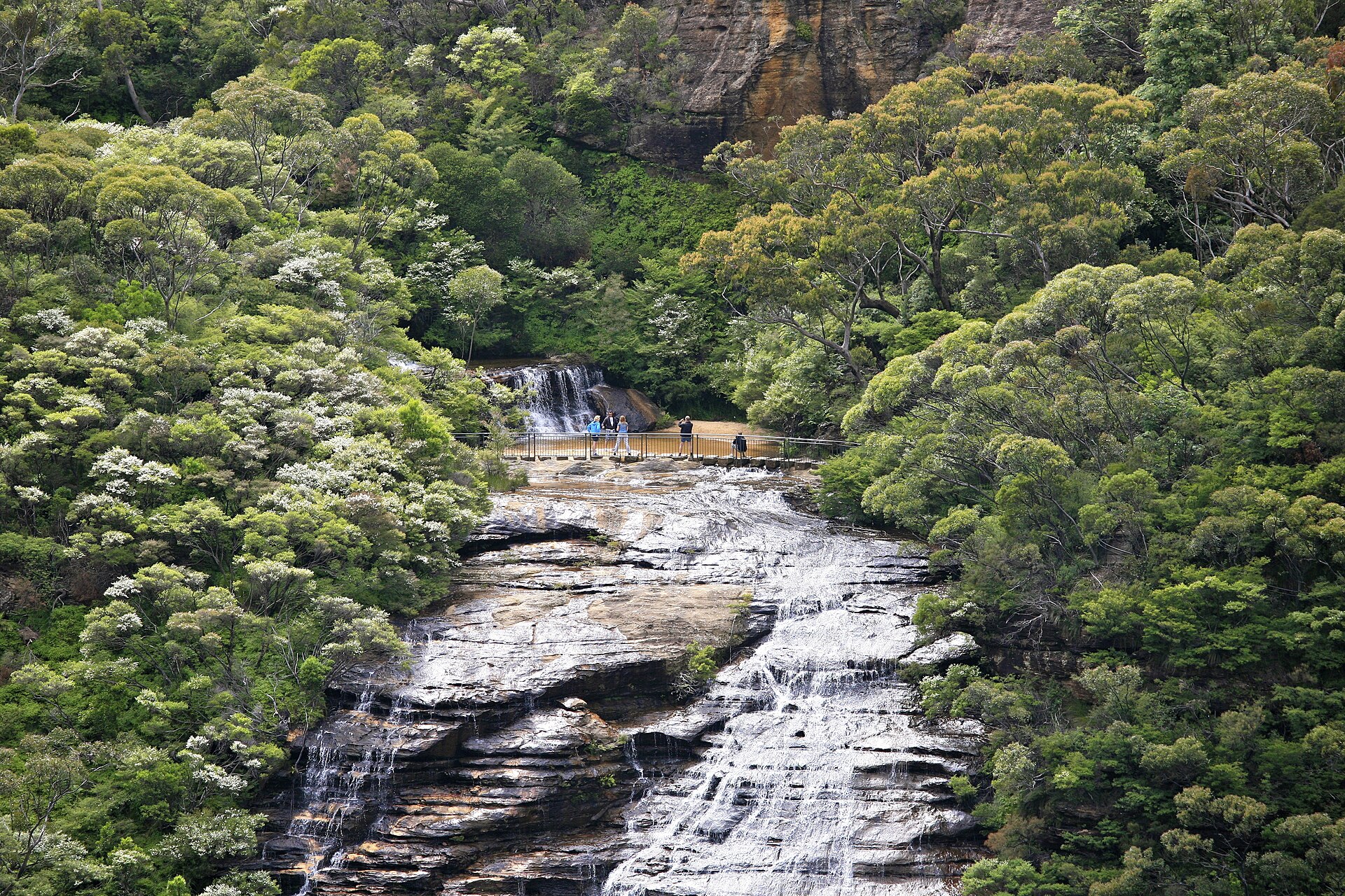
Wentworth Falls drops off the southern escarpment into the Jamison Valley in two main stages, around 190 metres in total, with a broad rock shelf between them known as the middle crossing. In heavy rain it is a genuinely powerful thing to stand near. In a dry February it is a damp streak on sandstone, and visitors who have travelled two hours to see it are visibly disappointed.
That variability is worth planning around. Mountains waterfalls are entirely rain-dependent and there is no reservoir upstream to smooth it out. If you want water, come within a few days of solid rain, or come in winter and spring rather than late summer. If you want the view rather than the water, the season matters much less.
The lookouts
- Wentworth Falls Lookout, at the picnic area, gives you the falls head-on across the gully. Short walk from the car park, largely level, and the standard stop.
- Princes Rock Lookout is the better one: about twenty minutes each way from the picnic area, ending on a rock platform that gives you the falls in profile with the whole Jamison Valley behind. Some steps, no great difficulty, and far fewer people.
- Jamison Lookout, a couple of minutes from the picnic area, is the accessible option — sealed path, valley view, no falls.
- Rocket Point, east along the clifftop, is quiet and rewarding if you have an extra half hour.
The walks that are open
Charles Darwin Walk — easy, 90 minutes
The one that starts in the village rather than at the car park, which makes it the natural choice if you arrive by train. It follows Jamison Creek from Wilson Park in the middle of Wentworth Falls down to the top of the falls, about two and a half kilometres one way, mostly on boardwalk through swamp and hanging swamp vegetation.
It is named for Charles Darwin, who came through in 1836 on the Beagle voyage and wrote about the view from the escarpment with the slightly stunned tone of a naturalist encountering something he had no category for. The walk is flat, shaded and genuinely interesting botanically — the upland swamp it crosses is a threatened ecological community and looks like nothing else on the ridge.
Ninety minutes one way at a strolling pace, and the best available answer to “we arrived by train and want a proper walk without a cliff descent”.
Princes Rock — easy to moderate, 40 minutes return
From the Wentworth Falls picnic area, down through bush and some steps to a rock platform. Short, and it delivers the single best view in the area.
Overcliff and Undercliff — moderate, 2 hours
A loop from the Conservation Hut at the western end, running along and below the clifftop with several small waterfalls. Check the current alerts before committing, because parts of the Valley of the Waters system connect to it and closures shift the available route. The Conservation Hut itself is the practical trailhead for the western side and a decent place to eat.
Wentworth Falls Lake — easy, an hour
Not the falls at all: a small lake on the northern side of the village with a flat circuit path, birdlife, picnic tables and a playground. Unspectacular and genuinely useful with small children or on a day when the escarpment is in cloud.
The National Pass, when it is open
Worth describing even though part of it is shut, because it is the reason serious walkers come to Wentworth Falls and because it will presumably reopen.
The National Pass is a track cut by hand into the middle of a cliff face between 1907 and 1908, running along a natural ledge roughly halfway down the escarpment, with the valley dropping away on one side and two hundred metres of sandstone rising on the other. The Grand Stairway at its eastern end is a set of steps carved directly into the rock. It is a piece of Edwardian engineering as much as a walking track, and there is nothing quite like it in Australia.
The full loop, when open, runs from the Conservation Hut down through the Valley of the Waters, east along the Pass beneath the cliff, past the base of Wentworth Falls, and up the Grand Stairway to the clifftop — around four to five kilometres and three hours, with a serious amount of vertical. With the western section closed, that loop is not currently available.
If you are reading this after the closure has lifted: do it clockwise, carry water, allow the full three hours, and do not attempt it in wet weather, when the cut steps become genuinely slippery.
Getting there
By train
Wentworth Falls is two stops before Katoomba on the Blue Mountains Line, about an hour and fifty minutes from Central, roughly A$9 each way on Opal with no booking. From the station, the village centre is immediate and the falls picnic area is about two kilometres south — a 25-minute walk down Falls Road, uphill on the way back. The Charles Darwin Walk starts from Wilson Park in the village, which makes it the obvious train-friendly option. Our Sydney to Blue Mountains train guide has the timetable pattern.
By car
About ninety minutes from Sydney via the M4 and the Great Western Highway. There is parking at the Wentworth Falls picnic area and at the Conservation Hut, and a vehicle entry fee applies in some drive-in areas of the national park. Both car parks fill on fine weekends. See our guide to driving in Sydney.
How it fits into a trip
Honestly: Wentworth Falls is a second-day destination rather than a first-day one. A visitor with a single day should go to Katoomba, see the Three Sisters and the Jamison Valley from Echo Point, and use the time on the clifftop rather than on a train two stops earlier. Our day trip itinerary is built that way for a reason.
Wentworth Falls earns its place on a second day, or on a return visit, or for anyone whose interest is walking rather than sightseeing — and in that case, with the current closures, Blackheath and the Grand Canyon track have a stronger claim. The regional guide covers how the towns compare and where to stay.
The village
Wentworth Falls the town is a quieter proposition than Katoomba or Leura and is rarely visited on purpose. It has a small shopping strip near the station, a couple of cafés, a bakery, a pub and a supermarket — enough to provision a walk and feed you afterwards, and not enough to fill an afternoon.
What it does have is the lake, on the northern side of the highway: a flat circuit of about an hour past reeds and picnic tables, with waterbirds and a playground. It is entirely unspectacular and it is exactly the right answer on a day when the escarpment is buried in cloud or when someone in the party is not up to a cliff walk.
Accommodation here is thinner than in the neighbouring towns — a handful of guesthouses and self-contained cottages, no budget tier and few restaurants open late. If you are staying overnight in the mountains and want options for dinner, Katoomba two stops west is the practical choice, and Blackheath the better one for food.
A half-day that currently works
With the closures in force, this is the sequence that still delivers a good half-day and does not depend on anything that is shut.
- Arrive by train mid-morning and walk five minutes to Wilson Park.
- Charles Darwin Walk down the creek to the top of the falls, about ninety minutes with stops, flat and shaded.
- Wentworth Falls Lookout and Princes Rock, forty minutes return from the picnic area, for the falls in profile and the Jamison Valley behind.
- Lunch at the Conservation Hut, or back in the village.
- Rocket Point east along the clifftop if there is time, or the lake if the weather has closed in.
- Uphill back to the station, allowing more time than you think — it is two kilometres and steadily up.
That is a full, honest half-day involving no closed track, no cliff descent and no car. Anyone with a whole day and functioning knees should spend it at Blackheath on the Grand Canyon instead, and come here for the walk along the creek.
Practical notes
- Check the alerts on the morning you go. Not the week before. NSW National Parks lists local alerts per track, and the Blue Mountains Heritage Centre at Blackheath takes calls on 02 4787 8877.
- Come after rain if you want the waterfall to be a waterfall.
- Carry water. There is nothing to buy below the clifftop, and the Conservation Hut is the only food on that side.
- Dress for altitude. Eight to ten degrees cooler than the Sydney CBD, and colder at the rail. Our packing guide applies with an extra layer.
- Mobile coverage is fine in the village and at the lookouts, patchy below the clifftop, absent in the valley.
- Stay behind the fences. The cliff edges here are undercut sandstone and give way without warning.
Frequently asked questions
Is the National Pass open?
Only in part. The section west of the Wentworth Falls middle crossing is closed after a major landslide, with no reopening date as of September 2026. Wentworth Pass, Slack Stairs and the Valley of the Waters below Sylvia Falls are also closed. Check the current NSW National Parks alerts before you travel.
How tall is Wentworth Falls?
Around 190 metres, dropping in two main stages with a rock shelf — the middle crossing — between them.
How long is the walk to Wentworth Falls?
From the picnic area, the main lookout is a few minutes and Princes Rock is about twenty minutes each way. From the village, the Charles Darwin Walk reaches the top of the falls in about ninety minutes on a flat boardwalk route.
Can I get to Wentworth Falls by train?
Yes. It is a station on the Blue Mountains Line, about an hour and fifty minutes from Central, two stops before Katoomba. The falls picnic area is a 25-minute walk south of the station, uphill on the way back.
Is Wentworth Falls better than the Three Sisters?
Different. The Three Sisters is the famous view and the busier one; Wentworth Falls is quieter, has a genuine waterfall, and — when the tracks are open — much better walking. A first-time visitor with one day should do the Three Sisters. A second visit belongs here or at Blackheath.
When is the best time to see the falls?
Within a few days of solid rain, and generally in winter and spring rather than late summer. There is no reservoir upstream, so the falls track the weather exactly.
Is there an accessible lookout?
Jamison Lookout, a couple of minutes from the picnic area on a sealed path, gives a valley view without steps. The falls lookouts themselves involve some uneven ground and steps.
What is the Charles Darwin Walk?
A flat, mostly boardwalked route following Jamison Creek from Wilson Park in the village down to the top of the falls, about two and a half kilometres and ninety minutes. It crosses an upland swamp that is a threatened ecological community, and it is named for Darwin’s 1836 visit.
Is Lincoln’s Rock open?
No, it was closed as of September 2026. It is managed by Blue Mountains City Council rather than National Parks, so check the council site for updates rather than the National Parks alerts.
Where can I eat?
The Conservation Hut at the western trailhead does food with a view, and the village has cafés and a small shopping strip near the station. There is nothing at all below the clifftop.
Related Sydney guides
- The Blue Mountains from Sydney — the full regional guide and where Wentworth Falls sits in it.
- The best Blue Mountains walks, ranked by effort — including everything currently closed.
- The Three Sisters and Echo Point — the first-day destination.
- Katoomba visitor guide — two stops west, and the main base town.
- Leura — the village in between.
- Sydney to Blue Mountains by train — fares, times and which station to use.
- Blue Mountains day trip itinerary — one day, hour by hour.
Photo Credits
Wentworth Falls upper stage: Blue Mountains – Wentworth Falls (6596121439) by Alex Proimos from Sydney, Australia, CC BY 2.0, via Wikimedia Commons.
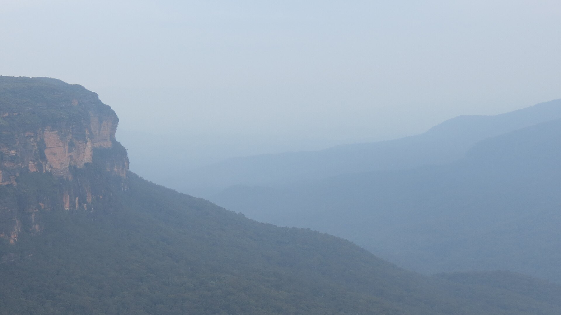
Blue haze over the Jamison Valley: Wentworth Falls, Blue Mountains, New South Wales (483626) (9440560675) by Robert Linsdell from St. Andrews, Canada, CC BY 2.0, via Wikimedia Commons.
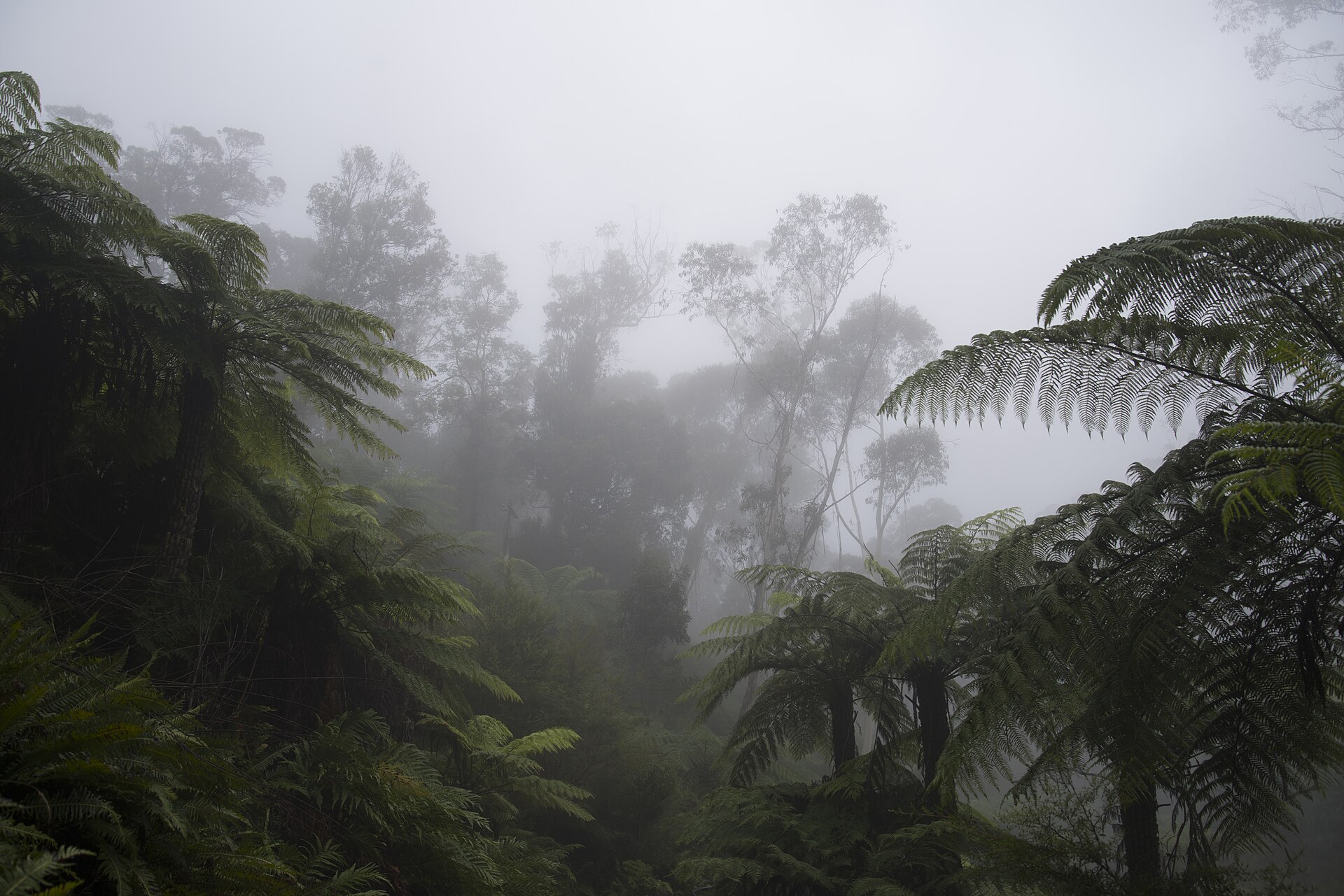
Fern gully photograph from the site library, sourced via Wikimedia Commons.