The Best Blue Mountains Walks, Ranked by Effort
Blue Mountains walks sorted by how hard they actually are, from a twenty-minute stroll to a seven-hour day - plus the tracks that are closed right now, checked with National Parks in September 2026.
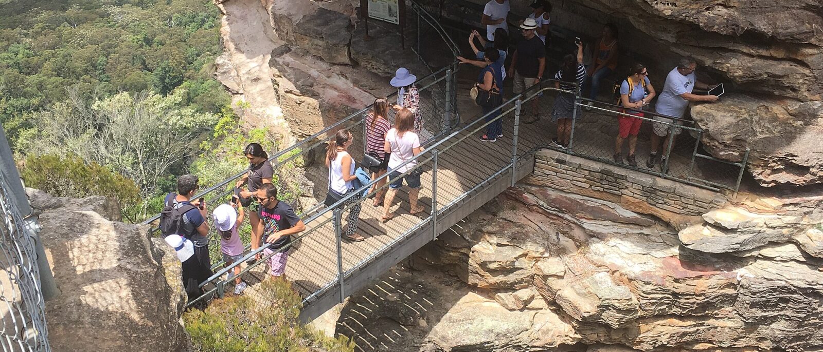
The thing that catches people out about Blue Mountains walks is not distance. It is the vertical. A six-kilometre loop here can involve four hundred metres of descent and the same again coming back out, which makes it harder than a twelve-kilometre walk on flat ground and considerably harder than the map suggests. There is no chairlift at the bottom of most of these tracks, and the climb out is always the last thing you do.
So this guide ranks the walks by effort rather than by scenery: what is genuinely easy, what is a real half-day, and what will take your whole day and your knees with it. It also lists, in plain terms, what is currently closed — because closures in this landscape are measured in years, not weekends, and several famous tracks are shut right now. Track status was checked against NSW National Parks on 9 September 2026. Check it again on the morning you walk.
What is closed right now
Read this before you plan anything. All of the following were closed as of 9 September 2026, most with no reopening date:
- National Pass — the section west of the Wentworth Falls middle crossing, closed after a major landslide. No reopening date given.
- Wentworth Pass and Slack Stairs — closed for elevated boardwalk repairs. No timeline.
- Valley of the Waters below Sylvia Falls — closed for rockfall risk.
- Roberts Pass, Hippocrene Falls and Vera Falls — inaccessible as a consequence of the three closures above.
- Lincoln’s Rock — closed. This one is managed by Blue Mountains City Council rather than National Parks, so check the council site.
- The Six Foot Track — closed at its western end between Jenolan Caves House and Binda Bush Cabins after April’s rainfall damage. Walkers must arrange their own transport to Binda Bush Cabins, 3780 Jenolan Caves Road, as an alternative trailhead. Jenolan Caves itself is closed until early 2027.
The Grand Canyon track is open and carried no alert on that date, which matters because it is the best medium walk in the region.
None of these are administrative closures. They are landslides, rockfalls and collapsed boardwalks on tracks cut into a cliff face. The signs are load-bearing. Ring the Blue Mountains Heritage Centre at Blackheath on 02 4787 8877 for current conditions, or check the local alerts page for your specific track.
The walks, ranked by effort
| Walk | Distance | Time | Effort | Start |
|---|---|---|---|---|
| Three Sisters Walk | 1 km return | 20–30 min | Easy | Echo Point, Katoomba |
| Scenic Walkway | 2.5 km | 30–60 min | Easy, boarded | Scenic World valley floor |
| Leura Cascades fern gully | 1 km | 20–30 min | Easy | Leura Cascades picnic area |
| Cliff Top Track | 3 km one way | 1 hr | Easy–moderate | Govetts Leap, Blackheath |
| Katoomba Falls Round Walk | 2.5 km loop | 1 hr | Moderate | Katoomba Falls picnic area |
| Prince Henry Cliff Walk | 7 km one way | 2–2.5 hr | Moderate | Leura or Echo Point |
| Narrow Neck fire trail | Up to 16 km return | 2–5 hr | Moderate, flat | Katoomba |
| Grand Canyon track | 6.3 km loop | 3–4 hr | Hard | Evans Lookout, Blackheath |
| Giant Stairway and Federal Pass | 6 km | 2–3 hr | Hard | Echo Point, Katoomba |
| Furber Steps, Federal Pass, Giant Stairway loop | ~9 km | 4–5 hr | Hard | Katoomba Falls |
| Ruined Castle | 14 km return | 6–7 hr | Very hard | Golden Stairs, Katoomba |
Easy: under an hour, no serious descent
Three Sisters Walk, Echo Point
A sealed kilometre from the Echo Point terrace down to Honeymoon Bridge, which puts you physically on the first Sister. Twenty to thirty minutes, some steps near the end, and by a wide margin the best effort-to-reward ratio in the mountains. If you do one walk here, this is the one. Full detail in our guide to the Three Sisters and Echo Point.
Cliff Top Track, Blackheath
Three kilometres from Govetts Leap to Evans Lookout along the top of the Grose Valley escarpment, roughly an hour one way, with the whole valley open on your left the entire time. Flat by mountains standards and startlingly empty compared with anything at Katoomba. Do it out and back, or arrange a car at the far end.
Leura Cascades
A short loop through a fern gully from the picnic area at the bottom of Leura Mall. Shaded, easy underfoot and pleasant in hot weather. Twenty to thirty minutes, and worth combining with a morning in the village — see our Leura guide.
Scenic Walkway
Two and a half kilometres of elevated boardwalk on the valley floor at Scenic World, through tree fern rainforest with the cliffs two hundred metres above. It requires a Scenic World pass, from A$64, but it is the only genuinely flat rainforest walk in the region and the only way into that landscape for anyone who cannot manage stairs. See our Scenic World guide.
Moderate: one to three hours, some climbing
Prince Henry Cliff Walk
The clifftop track linking Leura and Katoomba, roughly seven kilometres end to end and two to two and a half hours at a walking pace, with a dozen access points along the way. It passes a series of unnamed lookouts that nobody photographs, and it is the single best free walk in the mountains for the effort involved.
The clever version, and hardly anyone does it: take the train to Leura, walk the cliff to Echo Point, and catch the train home from Katoomba. Two shopping villages become a proper day out and you never retrace a step.
Katoomba Falls Round Walk
A loop of about two and a half kilometres from the Katoomba Falls picnic area, past the cascades and the falls and back along the clifftop. An hour, some steps, good after rain and modest in a dry February. A sensible afternoon addition to a day that has already done Echo Point.
Narrow Neck fire trail
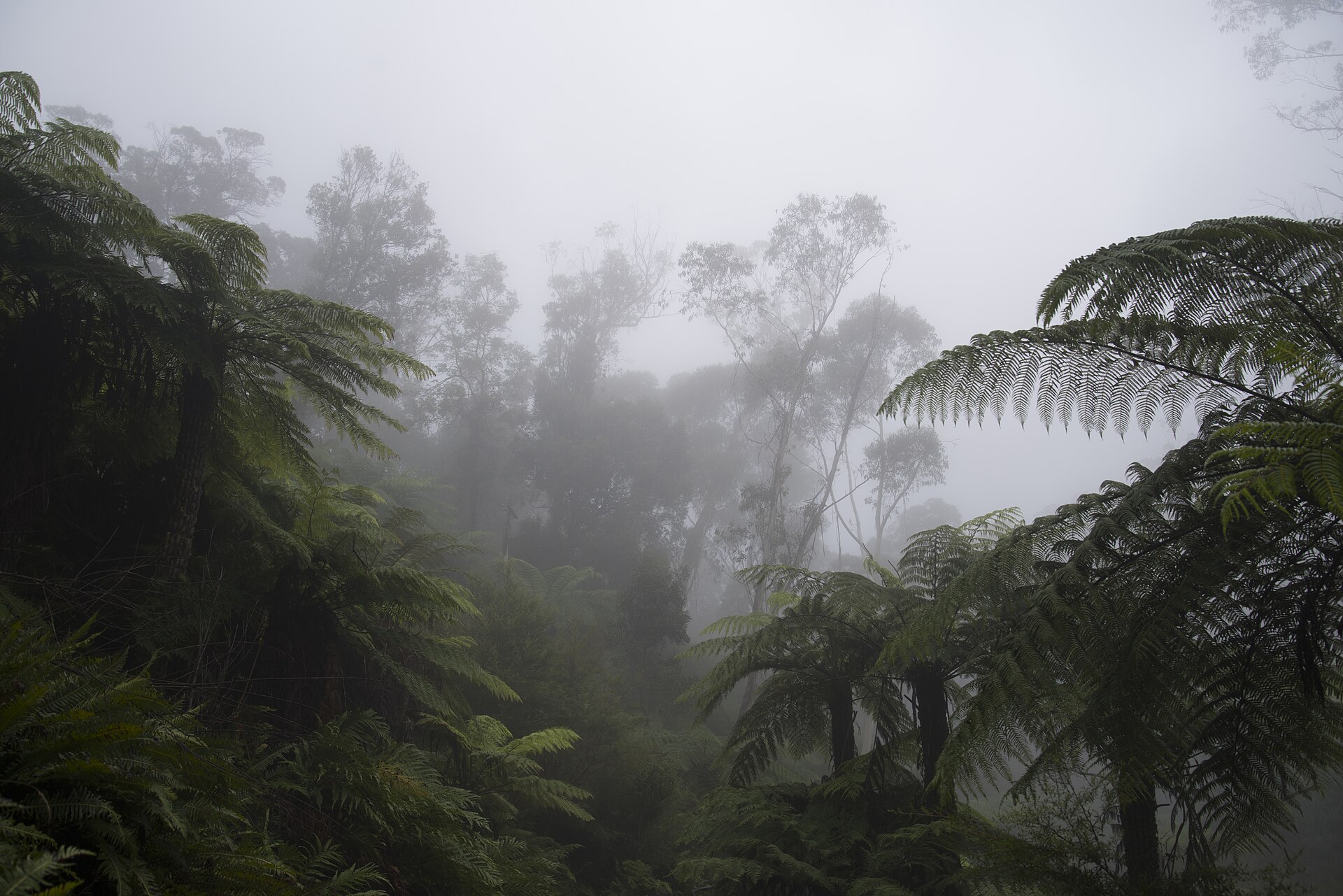
An unusual one: a wide, flat management trail running several kilometres out along a plateau finger, with the Jamison Valley dropping away on one side and the Megalong on the other. No climbing at all, spectacular the whole way, and you can turn around whenever you like. It is popular with mountain bikers and almost unknown to visitors. Two hours out and back is plenty; the full sixteen kilometres is a serious day.
Hard: half a day and several hundred vertical metres
Grand Canyon track, Blackheath
The best walk in the Blue Mountains for anyone with three or four hours and reasonable fitness. A 6.3-kilometre loop from Evans Lookout that drops into a narrow, fern-hung slot canyon with sandstone walls closing overhead, follows a creek through it, and climbs back out to the clifftop.
Do it clockwise so the long climb comes at the start rather than at the end, when you are tired. It is well-formed and signposted throughout, with steps, a tunnel section and several creek crossings that get slippery after rain. Allow three to four hours and do not treat it as a two-hour walk because the distance is small — the vertical is what costs you. It was open with no alert against it as of September 2026.
Giant Stairway and Federal Pass
From Honeymoon Bridge below Echo Point, roughly 900 steel and stone steps descend several hundred metres to the valley floor. From the bottom, the Federal Pass runs west along the base of the cliffs, through rainforest, to Scenic World, where you can ride out on the Railway or Cableway rather than climbing.
Two to three hours. The descent is harder on knees than the climb would be on lungs, and there is no shortcut back up. If you plan to exit through Scenic World, check its hours first — it closes at 16:00 on weekdays and 17:00 at weekends, and being at the bottom of a cliff after that is a long afternoon.
The full Katoomba loop
The walker’s version, and free: down the Furber Steps beside Katoomba Falls, east along the Federal Pass through the rainforest, and up the Giant Stairway to Echo Point, then the Prince Henry Cliff Walk back. Roughly nine kilometres, four to five hours, several hundred metres of descent and the same climbing. It shows you everything a Scenic World pass shows you and a good deal more, and it costs nothing. Carry two litres of water and start by ten.
Very hard: a full day
Ruined Castle
The knobbly ridge you can see out in the middle of the Jamison Valley from Echo Point. Reaching it means the Golden Stairs down from Narrow Neck, then several kilometres along the Federal Pass, then a climb onto the ridge — about fourteen kilometres return and six to seven hours. Superb, remote, and a genuine full-day undertaking rather than a long stroll.
Mount Solitary
The flat-topped mountain in the middle of the valley. It is normally done as an overnight walk with a camp on the top, and it is not a beginner’s route. Mentioned here so you know what you are looking at rather than as a suggestion.
Wentworth Falls, and what the closures leave you
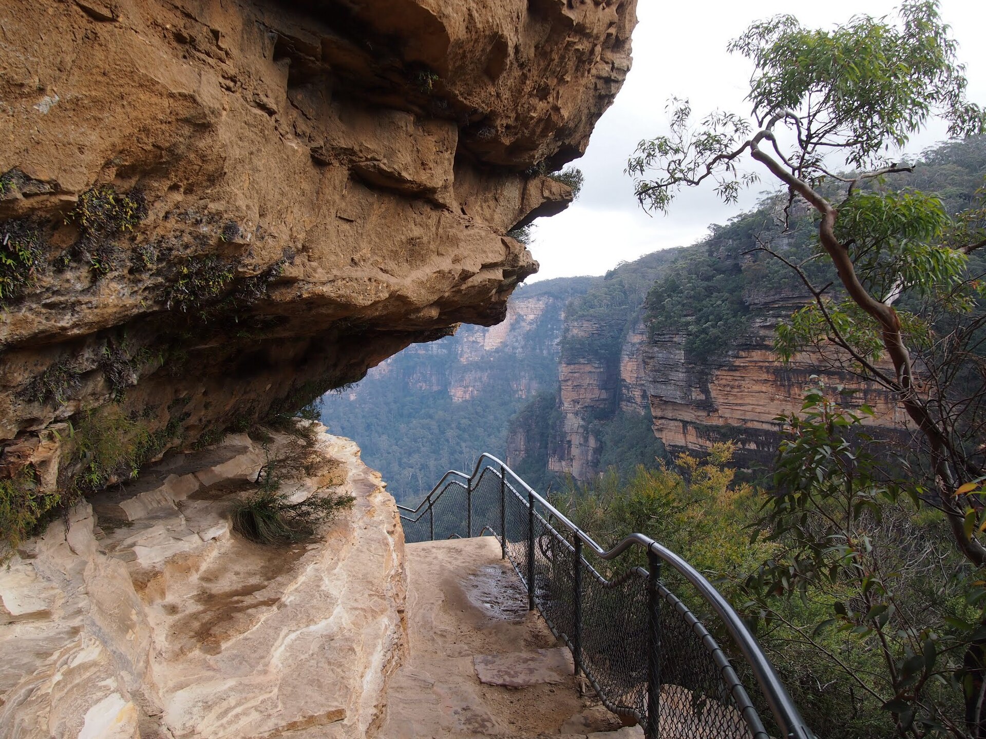
Wentworth Falls is the classic walking base in the mid-mountains and it is currently the most affected by closures. The National Pass — a track cut into the cliff face by hand at the turn of the twentieth century, and one of the great engineered walks in Australia — has a closed section west of the middle crossing. Wentworth Pass, Slack Stairs and the Valley of the Waters below Sylvia Falls are also shut.
What remains open at the time of writing is enough for a good half-day: the clifftop lookouts, the Charles Darwin Walk from Wentworth Falls village, and the upper sections around the falls themselves. But if the National Pass is specifically why you are going, check the alerts before you commit a day to it, and have the Grand Canyon track at Blackheath as a fallback. Our regional guide has the wider context.
Which base town for which walks
The towns sit in a line along the ridge and each one opens a different set of tracks. Choosing the wrong base is the commonest reason people end up driving between trailheads all day instead of walking.
- Katoomba — the Three Sisters Walk, the Giant Stairway, the Federal Pass, the Furber Steps, Katoomba Falls, Narrow Neck and the western half of the Prince Henry Cliff Walk. The densest set of tracks on the ridge, and all of it reachable on foot or on the 686 bus from the station. See our Katoomba guide.
- Leura — the Cascades, the eastern half of the Prince Henry Cliff Walk, and Sublime Point if you have a car. A thinner list, and prettier surroundings.
- Wentworth Falls — the falls themselves, the Charles Darwin Walk and the clifftop lookouts, with the National Pass system heavily restricted by closures.
- Blackheath — Govetts Leap, Evans Lookout, the Cliff Top Track, Pulpit Rock and the Grand Canyon. This is the walkers’ base, and it is quieter and better fed than Katoomba. If you have two nights and any intention of walking properly, stay here.
- Glenbrook and the lower mountains — a different landscape entirely: warmer, lower, with swimming holes, wild kangaroos around the Euroka area and easy family walking. No great escarpment views.
Canyoning, and the Six Foot Track
Two things visitors ask about that sit outside ordinary bushwalking.
Canyoning — the Blue Mountains have some of the best slot canyons in the world, and descending them involves abseiling, swimming through cold water and route-finding in confined spaces. This is not a walk you can improvise. Several licensed operators run guided trips from Katoomba and Blackheath, ranging from beginner-friendly half-days to serious full descents. Going with a guide is the sensible choice, not a soft option; people get into trouble in these canyons every year.
The Six Foot Track — a 45-kilometre route from Katoomba to Jenolan Caves, cut in the 1880s as a bridle track and normally walked over three days with two camps. It is one of the classic Australian multi-day walks. As of September 2026 it is closed between Jenolan Caves House and Binda Bush Cabins after April’s rainfall damage, and Jenolan Caves itself is shut until early 2027 — walkers must arrange their own transport to Binda Bush Cabins at 3780 Jenolan Caves Road as an alternative trailhead. Check current status before planning around it.
What you need
- Water, more than feels sensible. Two litres for anything on the hard list. There is nothing to buy on a valley floor.
- Real shoes. Sandstone gets genuinely slick when damp and the steps are steep. Trainers with grip are fine; thongs are not.
- A layer more than the coast needs. Katoomba runs eight to ten degrees below the Sydney CBD, and the valley floor is cooler and damper again. Our packing guide covers the rest.
- An offline map. Mobile coverage is patchy on the clifftops and non-existent in the valleys. See our travel apps guide.
- A head torch for anything on the hard list in winter, when useful daylight in the valley ends well before it does in Sydney.
- Sunscreen even in June. Altitude plus Australian sun is efficient.
Safety, briefly and seriously
Three rules that locals treat as non-negotiable.
Stay behind the fences. The sandstone at cliff edges is friable and undercut, and it gives way without warning. There are fatalities in this landscape most years and almost all of them involve someone stepping past a barrier.
Do not start a valley descent after 2pm in winter. Dark arrives fast in a gorge and the climb out always takes longer than the descent did.
Tell someone your route. There is no phone signal down there. A note to whoever you are travelling with, naming the track and the expected finish time, costs nothing.
Add one more in summer: check the fire danger rating before you leave Sydney. December to February is high fire season here and the park closes at short notice in severe conditions. Valley walking in the middle of a hot day is genuinely dangerous, not merely unpleasant.
Picking a walk in thirty seconds
- One hour, no fitness, want the famous view: Three Sisters Walk.
- One hour, want to be alone: Cliff Top Track at Blackheath.
- Two hours, no car, want a proper walk: Prince Henry Cliff Walk, Leura to Katoomba.
- Two hours, flat, spectacular: Narrow Neck fire trail.
- Half a day, fit, want the best walk here: Grand Canyon track, clockwise.
- Half a day, want the valley floor without paying: Furber Steps, Federal Pass, Giant Stairway.
- Cannot manage steps: Scenic Walkway, with a Scenic World pass.
- A whole day, experienced: Ruined Castle.
Frequently asked questions
What is the best walk in the Blue Mountains?
The Grand Canyon track at Blackheath, a 6.3-kilometre loop of three to four hours through a slot canyon, for anyone with reasonable fitness. For anyone without, the Three Sisters Walk at Echo Point — a kilometre return with an extraordinary payoff.
Is the National Pass open?
Only partly. The section west of the Wentworth Falls middle crossing is closed after a major landslide, with no reopening date as of September 2026. Wentworth Pass, Slack Stairs and the Valley of the Waters below Sylvia Falls are also closed. Check the current alerts before travelling.
Is the Grand Canyon track open?
Yes, it carried no alert as of 9 September 2026. It is the strongest medium-difficulty walk in the region, and worth checking again on the morning you go.
How many steps is the Giant Stairway?
Roughly 900, dropping several hundred metres from Honeymoon Bridge to the valley floor. Coming back up is possible; most people instead walk the Federal Pass to Scenic World and ride out, or climb the Furber Steps.
Can you walk in the Blue Mountains without a car?
Yes, and well. The Three Sisters Walk, the Prince Henry Cliff Walk, the Katoomba Falls Round Walk and the whole Furber Steps and Federal Pass system are all reachable from Katoomba station on foot or with the 686 bus. The Grand Canyon track needs a taxi from Blackheath station, or a 40-minute walk to Govetts Leap. See our train guide.
How hard are Blue Mountains walks really?
Harder than the distances suggest, because of the vertical. A six-kilometre loop with 400 metres of descent and 400 of climb is a genuine half-day for an average walker. Treat the time estimates as more reliable than the distances.
When is the best time of year to walk?
Autumn, March to May, and spring, September to November — stable weather, comfortable temperatures. Winter is cold but excellent for walking, with the caveat of short days. Summer is the problem: hot, and valley tracks become dangerous in the middle of the day. Our best time to visit guide has the seasonal picture.
Are there guided walks?
Yes, several operators run guided day walks and canyoning trips from Katoomba and Blackheath, and NSW National Parks runs occasional guided programmes. For a first canyoning experience a guide is genuinely necessary rather than optional.
Do I need a permit?
No, day walking in Blue Mountains National Park is free and needs no permit. Some drive-in areas charge vehicle entry. Overnight walks in remote areas have their own requirements, so check with National Parks.
Where can I check track closures?
The NSW National Parks local alerts page for your specific track, or the Blue Mountains Heritage Centre at Blackheath on 02 4787 8877. For council-managed sites such as Lincoln’s Rock, check Blue Mountains City Council. Do this on the morning you walk, not the week before.
Because the closures fall so heavily on one town, we have given it a page of its own. Our Wentworth Falls guide sets out which lookouts and tracks are still open, how long each takes, and the half-day sequence that avoids every closed section — useful if you had the National Pass pencilled in.
Anyone planning the Six Foot Track should check its western end first: it is closed between Jenolan Caves House and Binda Bush Cabins after April’s rainfall damage, and the caves themselves are shut until early 2027. Our Jenolan Caves guide has the access detail and the alternative trailhead.
A word of warning if you are weighing a guided day trip against coming up under your own steam: standard coach and minibus tours leave little more than two hours on the ground in the mountains, which rules out every walk on this page beyond a short lookout stroll. Our comparison of Blue Mountains day tours sets out what each type allows.
Blackheath is at its most colourful in early November, when the Rhododendron Festival parade fills the village and the cool-climate gardens are in full flower; Govetts Leap and Evans Lookout are a short walk away. Our Sydney in November guide has the 2026 festival date and the fire-danger advice for spring walks.
Related Sydney guides
- The Blue Mountains from Sydney — the full regional guide, the lookouts and where to stay.
- The Three Sisters and Echo Point — the easiest walk here and the busiest lookout.
- Katoomba visitor guide — the base town for most of these tracks.
- Leura — the eastern end of the Prince Henry Cliff Walk.
- Scenic World Katoomba — the assisted way in and out of the valley.
- Bondi to Coogee coastal walk — the city’s best walk, for the days you are not in the mountains.
- Day trips from Sydney — everything else within two hours.
Photo Credits
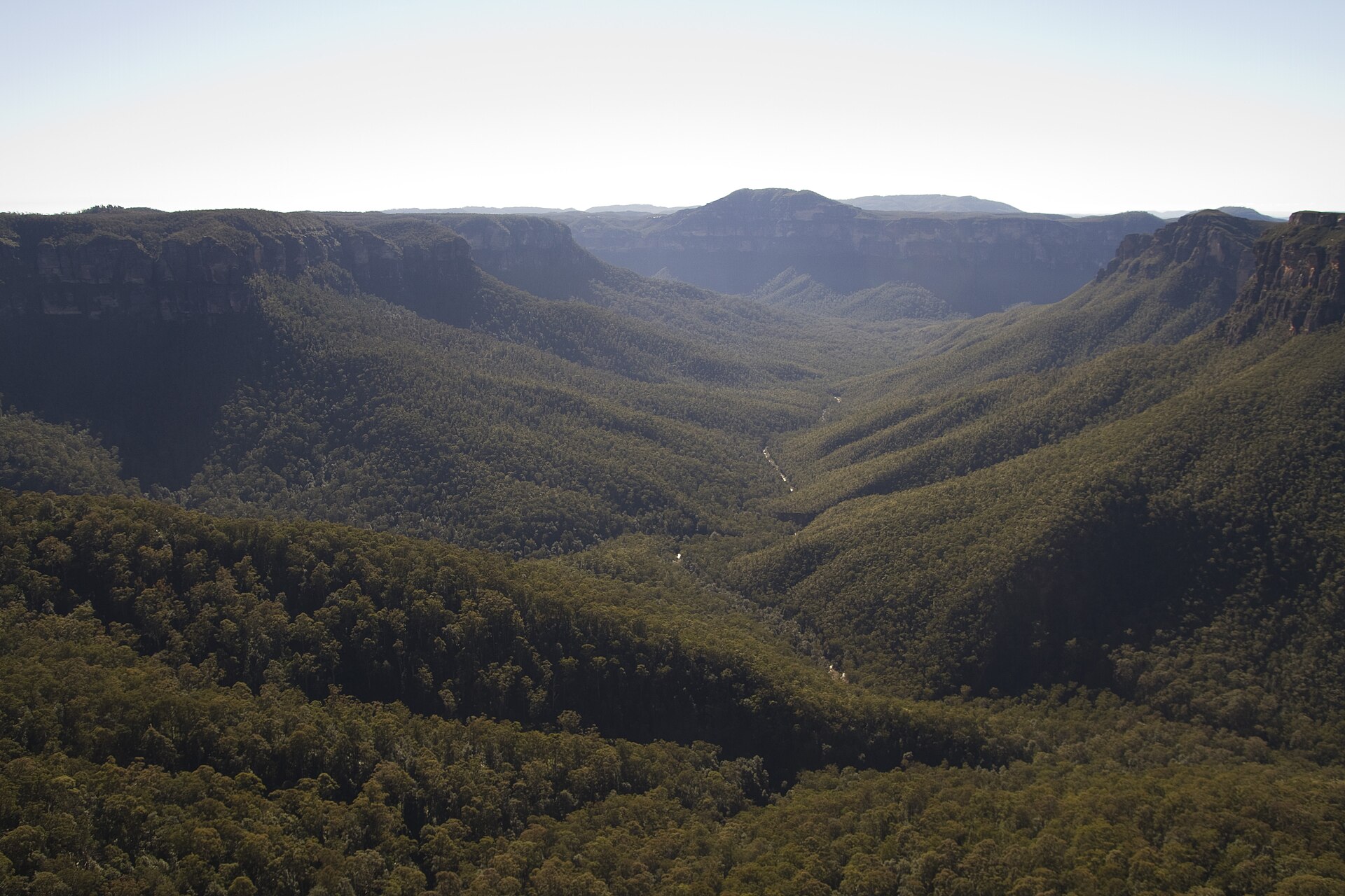
Grose Valley from Evans Lookout: 2013-07-03 Evans Lookout 01 by Maksym Kozlenko, CC BY-SA 4.0, via Wikimedia Commons.
The National Pass: National Pass – panoramio by Maurice van Creij, CC BY 3.0, via Wikimedia Commons.
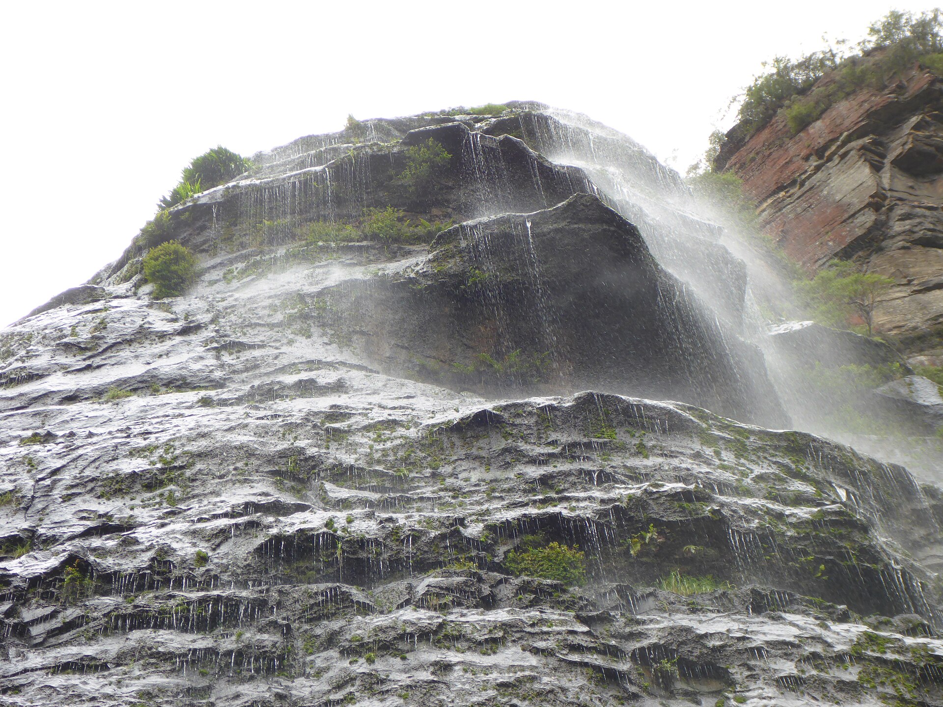
Rainforest and waterfall photographs from the site library, sourced via Wikimedia Commons.